18 - 19 FEBRUARY 1996 - WARM FRONT
by ZAMG
| Front Indicator | This is a line indicating the maximum of the thermal front parameter (TFP) 500/850 hPa (*10-1Km-1). |
|---|---|
| TFP + WLA | This is a combination of the thermal front parameter (TFP) 500/850 hPa greater than 3 units and warm advection (WA) 500/1000 hPa (K 12h-1); this combination of key parameters is especially indicative of the thermal characteristics of a Warm Front. |
| TA>=0 | This parameter shows maxima of warm advection; although already contained in TFP + WA, sometimes the necessity arises to look at this field separately. |
| Relative Stroeme | This parameter shows relative streams on isentropic surfaces; relative streams are indicative of the different air masses involved in the process and of areas of sinking or rising motion; they can be used to explain cloud configurations not normally encountered. |
| VQS | Gives the location of available vertical cross sections (VQS) |
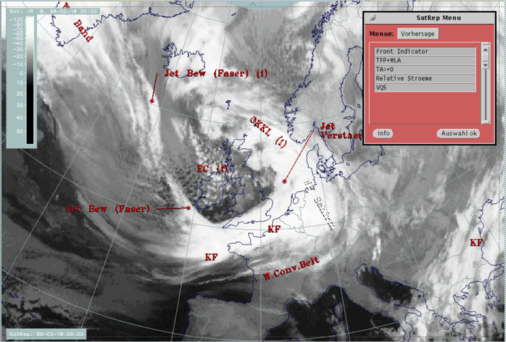
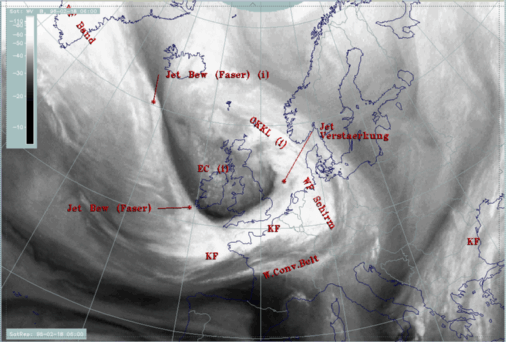
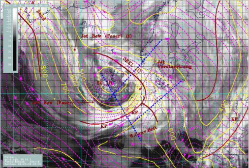
The IR satellite image shows a cloud shield over the Netherlands and western Germany without any significant structure; the WV image contains a notable Dark Stripe at the leading eastern cloud edge. This dry air appears typically at that position and marks the cyclonic side of the jet axis accompanying the Warm Front cloud edge (compare Cloud fibre at jet axis ).
|
18 February 1996/06.00 UTC - Meteosat WV image; SatRep overlay: names of conceptual models
|
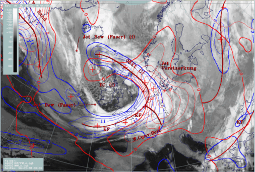
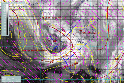
18 February 1996/06.00 UTC - Meteosat IR image; blue: thermal front parameter (TFP) 500/850 hPa, red thick: front indicator, red: temperature
advection - WA 1000 hPa;
|
|
|
Explanations for these typical structures can be found by looking at vertical cross sections and relative streams, especially the "Warm Conveyor Belt".
|
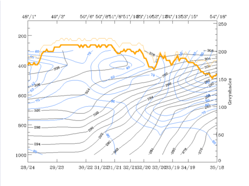
18 February 1996/06.00 UTC - Vertical cross section; black: isentropes (ThetaE), blue: relative humidity, orange thin: IR pixel values,
orange thick: WV pixel values
|
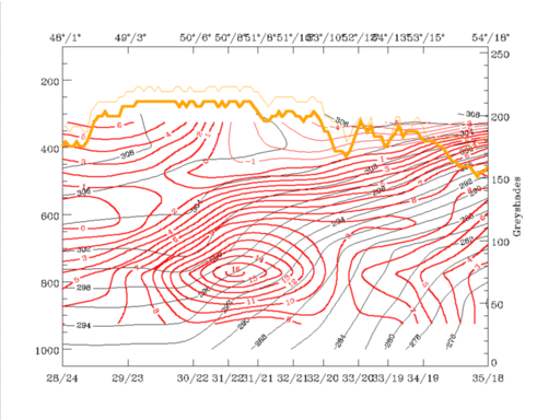
18 February 1996/06.00 UTC - Vertical cross section; black: isentropes (ThetaE), red thick: temperature advection - WA, red thin: temperature
advection - CA, orange thin: IR pixel values, orange thick: WV pixel values
|
|
|
The relative humidity shows high values of 90% (up to about 700 hPa) and 70% (up to about 450 hPa) on top of this frontal surface. This characterizes the humid air gliding upwards while dry air is sinking below the frontal surface from heights around 400 hPa, where it is only 10% down to about 700 hPa where it is about 50%. Temperature advection consists of a broad zone of pronounced WA with maximal values within the frontal zone.
Both parameter fields show a transition zone between 600 and 400 hPa close to the southern end of the vertical cross section (48N/01E) where humidity decreases to 30% and WA to 0. Above this layer, between 400 and 300 hPa, a second area of WA with very humid air involved is indicated. This is an upper level Warm Front zone separated from the main warm front. Comparing with the satellite image, the accompanying cloudiness can be found within the warm sector where a second WA maximum has already been discussed. Satellite signals in the vertical cross section (orange lines) show a broad area of cold pixels reaching from the area just discussed north-eastward over the surface front. Only some distance away from the surface front (north-eastward direction) cloud top temperatures decrease. The sharp decrease at about 52N/11E is connected with the Dark Stripe in the WV image already discussed.
For investigations of relative streams the same isentropic surfaces are chosen as for the Cold Front: 298K and 304K. The 298K surface is close to the top of the frontal zone, the 304K surface already above.
|
18 February 1996/06.00 UTC - Meteosat IR image; magenta: relative streams 298K - system velocity 305° 18m/s, yellow: isobars, red: front
indicator, ECMWF grid superimposed, position of vertical cross section indicated
|
18 February 1996/06.00 UTC - Meteosat IR image; magenta: relative streams 305K - system velocity 305° 18m/s, yellow: isobars, red: front
indicator, ECMWF grid superimposed, position of vertical cross section indicated
|
|
|
The Warm Front situation in this case study fulfils the conceptual model considerations very well.


