24 - 30 SEPTEMBER 1997 - THE TEAR-OFF STAGE
by KNMI
Synoptic situation
|
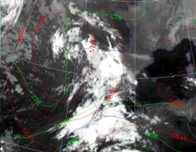
24 September 1997/23.00 UTC - Meteosat VIS image; green: equivalent thickness 500/850 hPa, red: height contours 500 hPa
|
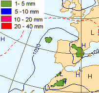
25 September 1997/00.00 UTC - Surface chart; accumulated precipitation 12.00 - 00.00 UTC
|
|
|
The cloud band over Spain no longer has any connection with the original front over the Bay of Biscay and Ireland.
26 September 1997/00.00 UTC
Analysis of the system|
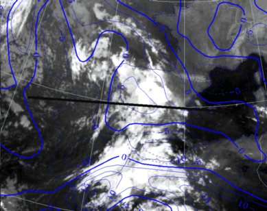
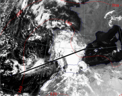
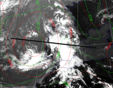
26 September 1997/00.00 UTC - Meteosat IR image; blue: thermal front parameter (TFP) 500/850 hPa; position of vertical cross section indicated
|
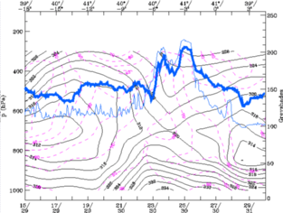
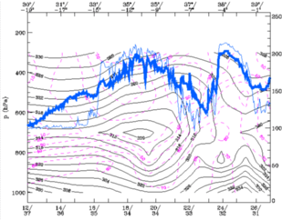
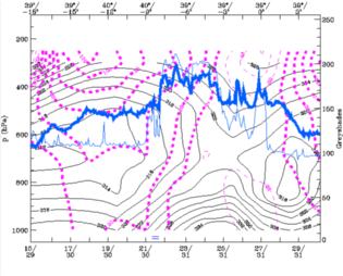
26 September 1997/00.00 UTC - Vertical cross section; black: isentropes (ThetaE), magenta: relative humidity, blue thin: IR pixel
values, blue thick: WV pixel values
|
|
|
This is a combination of the front which came from the west at 25/9 and the baroclinic zone over Morocco that day. The TFP from the model now fits quite well with the cloud pattern. The more eastern front over NE Spain on the 25 September has dissolved almost completely.
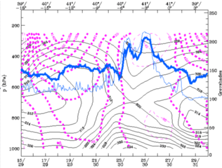
In the cross section the front has the characteristics of an occlusion. The ThetaE pattern also shows a strong unstable layer below 700 hPa in that area.
|
26 September 1997/00.00 UTC - Meteosat IR image; red: height of PV=2 units
|
26 September 1997/00.00 UTC - Vertical cross section; black: isentropes (ThetaE), magenta: relative vorticity, blue thin: IR pixel
values, blue thick: WV pixel values
|
|
|
26 September 1997/12.00 UTC
Analysis of the system|
26 September 1997/12.00 UTC - Meteosat IR image; blue: thermal front parameter (TFP) 500/850 hPa; position of vertical cross section indicated
|
26 September 1997/12.00 UTC - Vertical cross section; black: isentropes (ThetaE), blue: relative humidity, blue thin: IR pixel
values, blue thick: WV pixel values
|
|
|
|
26 September 1997/12.00 UTC - Meteosat IR image; red: height 1000 hPa; position of vertical cross section indicated
|
26 September 1997/12.00 UTC - Vertical cross section; black: isentropes (ThetaE), magenta: relative humidity, blue thin: IR pixel
values, blue thick: WV pixel values
|
|
|
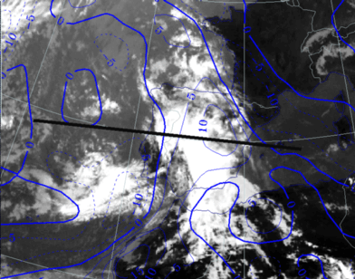
This cloud shield is the result of upper level convergence which is often observed at the western and southern part of an ULL in its tear-off stage.
|
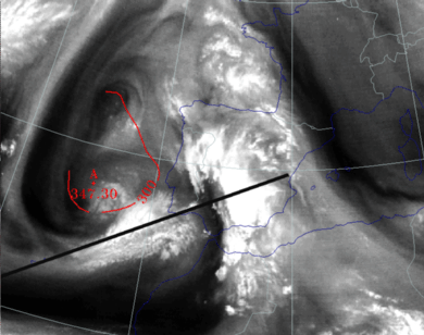
26 September 1997/12.00 UTC - Meteosat IR image; red: height of PV=2 units; position of vertical cross section indicated
|
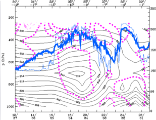
26 September 1997/12.00 UTC - Vertical cross section; black: isentropes (ThetaE), magenta thick: vorticity advection - PVA, magenta
thin: vorticity advection - NVA, blue thin: IR pixel values, blue thick: WV pixel values
|
|
|
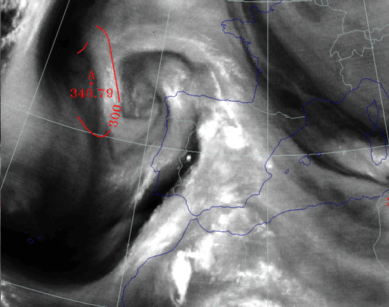
In the WV image two vortexes can be detected. Both are in an area of low tropopauses as can be seen by the relative low height of the PV = 2 in that area, with a minimum of 347 hPa near the centre of the southern vortex. The two rotation centres form a "mushroom" configuration which is known in literature as the start of a cut-off process in the development of an ULL.
|
26 September 1997/12.00 UTC - Meteosat IR image; green: equivalent thickness 500/850 hPa, red: height contours 500 hPa
|
26 September 1997/12.00 UTC - Vertical cross section; black: isentropes (ThetaE), magenta: relative vorticity, blue thin: IR pixel values,
blue thick: WV pixel values
|
|
|
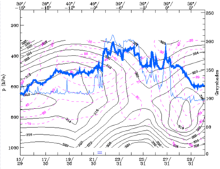
Cold advection prevails over the Atlantic Ocean (West of Portugal), whilst warm advection is still going on above the whole Iberian Peninsula. This can be seen in the contours at 500 hPa, which are perpendicular to the lines of equivalent thickness, meaning the ULL is still moving and developing.
The cross section shows strong vorticity in the centre of the ULL especially at higher levels (300hPa).


