24 - 30 SEPTEMBER 1997 - THE UPPER LEVEL TROUGH STAGE
by KNMI
Synoptic situation
|
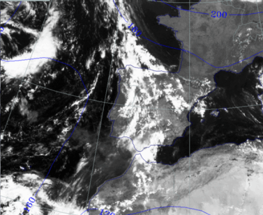
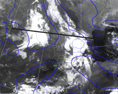
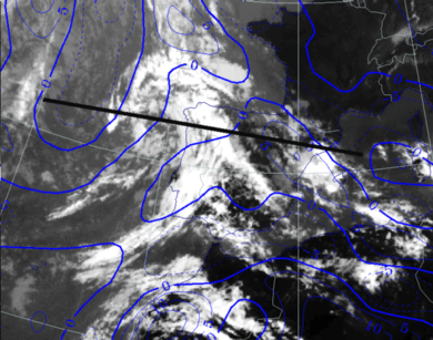
24 September 1997/12.00 UTC - Meteosat VIS image; blue: height contours 1000 hPa
|
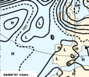
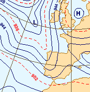
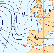
24 September 1997/12.00 UTC - Surface chart
|
|
|
Between 40N and 50N, at a longitude of about 20W, a frontal zone is moving eastwards in the direction of the Iberian peninsula.
24 September 1997/12.00 UTC
Analysis of the system|
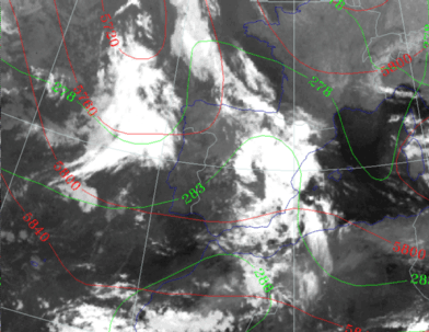
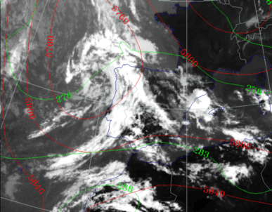
24 September 1997/12.00 UTC - Meteosat IR image; blue: thermal front parameter (TFP) 500/850 hPa, cyan: vorticity 500 hPa; position of vertical
cross section indicated
|
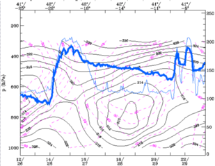
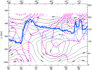
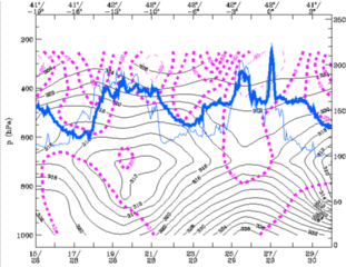
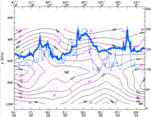
24 September 1997/12.00 UTC - Vertical cross section; black: isentropes (ThetaE), magenta: relative humidity, blue thin: IR pixel
values, blue thick: WV pixel values
|
|
|
|
|
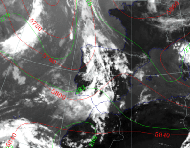
24 September 1997/12.00 UTC - Meteosat IR image; green: equivalent thickness 500/850 hPa, red: height contours 500 hPa
|
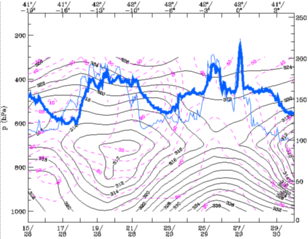
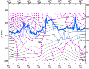
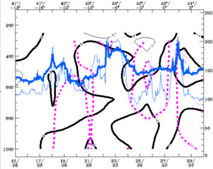
24 September 1997/12.00 UTC - Vertical cross section; black: isentropes (ThetaE), magenta: relative vorticity, blue thin: IR pixel
values, blue thick: WV pixel values
|
|
|
The vorticity maxima in the troughs behind both fronts are very distinct, both at the 500hPa level and in the cross section. In the cross section the highest values of vorticity appear at a higher level than 500 hPa. The 300hPa level is more representative of the situation (see chart below).
24 September 1997/12.00 UTC - 300 hPa contours
The smaller trough at 20W is of particular interest. This trough is moving rapidly eastward into the main trough and reactivates this trough for the further development of the trough into an Upper Level Low ("trigger" mechanism).
25 September 1997/00.00 UTC
Analysis of the system|
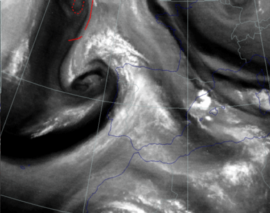
25 September 1997/00.00 UTC - Meteosat IR image; blue: thermal front parameter (TFP) 500/850 hPa; position of vertical cross section indicated
|
25 September 1997/00.00 UTC - Vertical cross section; black: isentropes (ThetaE), magenta: relative humidity, blue thin: IR pixel
values, blue thick: WV pixel values
|
|
|
|
25 September 1997/00.00 UTC - Meteosat IR image; green: equivalent thickness 500/850 hPa, red: height contours 500 hPa
|
25 September 1997/00.00 UTC - Vertical cross section; black: isentropes (ThetaE), magenta: relative vorticity, blue thin: IR pixel
values, blue thick: WV pixel values
|
|
|
25 September 1997/00.00 UTC - 300 hPa contours
25 September 1997/12.00 UTC
Analysis of the system|
25 September 1997/12.00 UTC - Meteosat IR image; blue: thermal front parameter (TFP) 500/850 hPa; position of vertical cross section indicated
|
25 September 1997/12.00 UTC - Vertical cross section; black: isentropes (ThetaE), magenta: relative humidity, blue thin: IR pixel
values, blue thick: WV pixel values
|
|
|
In the area of the cloud band over Morocco the model also indicates a well developed TFP.
|
25 September 1997/12.00 UTC - Meteosat IR image; green: equivalent thickness 500/850 hPa, red: height contours 500 hPa
|
25 September 1997/12.00 UTC - Vertical cross section; black: isentropes (ThetaE), magenta: relative vorticity, blue thin: IR pixel
values, blue thick: WV pixel values
|
|
|
|
25 September 1997/12.00 UTC - Meteosat WV image; red: height of PV=1 unit
|
25 September 1997/12.00 UTC - Vertical cross section; black thin: divergence, black thick: convergence, magenta thick: vertical motion (omega) -
upward motion, magenta thin: vertical motion (omega) - downward motion, blue thin: IR pixel values, blue thick: WV pixel values
|
|
|


