17 APRIL 1996 - RAPID CYCLOGENESIS: FORECAST FOR "SPECIAL INVESTIGATION" 17 APRIL 12.00 UTC TO 18.00 UTC
by ZAMG
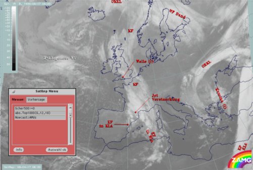
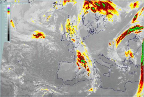
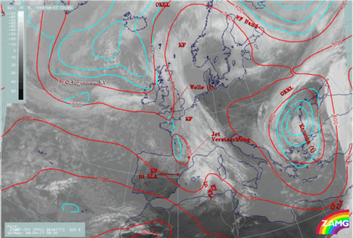
17 April 1996/06.00 UTC - Meteosat IR image; SatRep overlay: names of conceptual models, SatRep menu: key parameters for Rapid Cyclogenesis forecast
The very short range forecast VSRF (06.00 - 18.00 UTC, 12 hours)
For the very short range forecast, six-hourly forecasts from ECMWF are used and those parameters which are key parameters of a conceptual model are prepared as overlays on the satellite image in three different colours representing the three points of time 06.00, 12.00 and 18.00 UTC:- yellow: 06.00 UTC
- green: 12.00 UTC
- blue: 18.00 UTC
Nowcasting (0-2 hours)
For this forecast time atmospheric motion vectors (AMVs) are used which extrapolate the cloud systems for the next two hours. These nowcasts are renewed half-hourly or hourly and are not discussed here.|
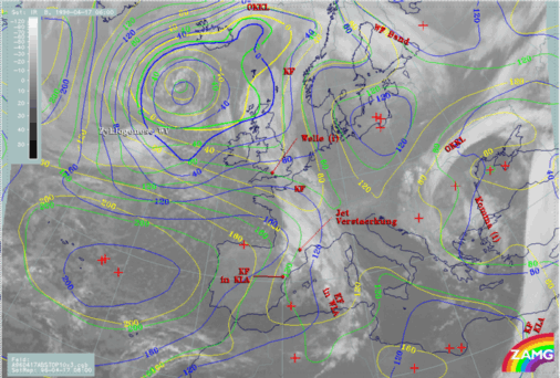
17 April 1996/06.00 UTC - Meteosat IR image; yellow: height contours 1000 hPa 06.00 UTC, green: height contours 1000 hPa 12.00 UTC, blue: height
contours 1000 hPa 18.00 UTC; SatRep overlay: names of conceptual models
|
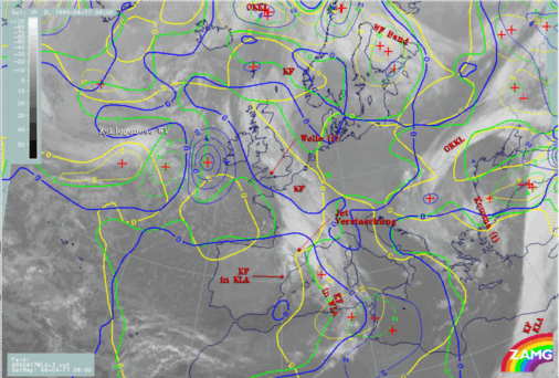
17 April 1996/06.00 UTC - Meteosat IR image; yellow: temperature advection - WA 1000 hPa 06.00 UTC, green: temperature advection - WA 1000 hPa 12.00
UTC, blue: temperature advection - WA 1000 hPa 18.00 UTC; SatRep overlay: names of conceptual models
|
|
|
|
|
|
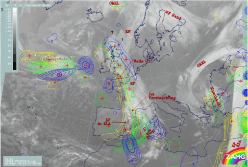
17 April 1996/06.00 UTC - Meteosat IR image; yellow: positive vorticity advection (PVA) 500 hPa 06.00 UTC, green: positive vorticity advection
(PVA) 500 hPa 12.00 UTC, blue: positive vorticity advection (PVA) 500 hPa 18.00 UTC; SatRep overlay: names of conceptual models
|
|
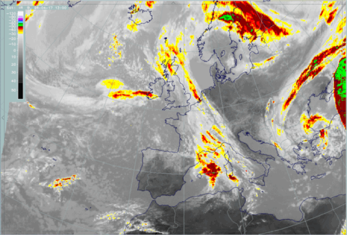
17 April 1996/06.00 UTC - Meteosat IR enhanced image
|
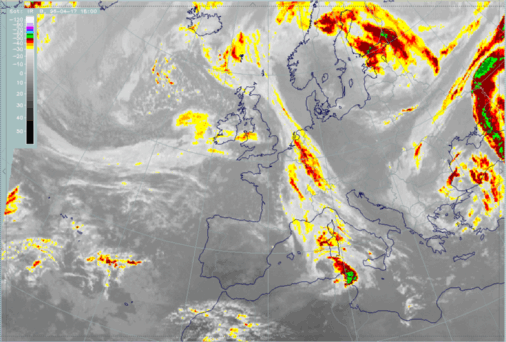
17 April 1996/06.00 UTC - Meteosat IR enhanced image
|
|
|
|
|
|
17 April 1996/06.00 UTC - Meteosat IR enhanced image
|
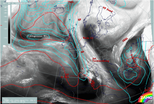
For the diagnosis stage additional parameters like PV have been discussed and it was concluded that a low isentropic level does not contain any stratospheric air in the area under consideration and that a higher isentropic level shows some typical features in this key parameter but somewhat displaced to the south (compare Rapid Cyclogenesis: Diagnosis for 17 April 06.00 UTC ). Bearing this result in mind, the forecast fields of PV can be understood in the same manner.
|
17 April 1996/12.00 UTC - Meteosat IR image; cyan: potential vorticity (PV) 305K, red: isobars; SatRep overlay: names of conceptual models
|
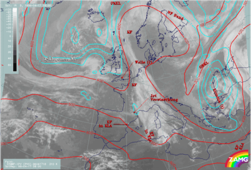
17 April 1996/12.00 UTC - Meteosat IR image; cyan: potential vorticity (PV) 320K, red: isobars; SatRep overlay: names of conceptual models
|
|
|
|
|
|
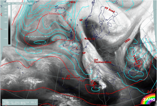
17 April 1996/18.00 UTC - Meteosat IR image; cyan: potential vorticity (PV) 310K, red: isobars; SatRep overlay: names of conceptual models
|
17 April 1996/18.00 UTC - Meteosat IR image; cyan: potential vorticity (PV) 320K, red: isobars; SatRep overlay: names of conceptual models
|
This is a case of Rapid Cyclogensis, where the numerical model of ECMWF is not completely ignoring this process but should be corrected at least in respect to the position.

