17 APRIL 1996 - RAPID CYCLOGENESIS: DIAGNOSIS FOR 17 APRIL 06.00 UTC
by ZAMG
|
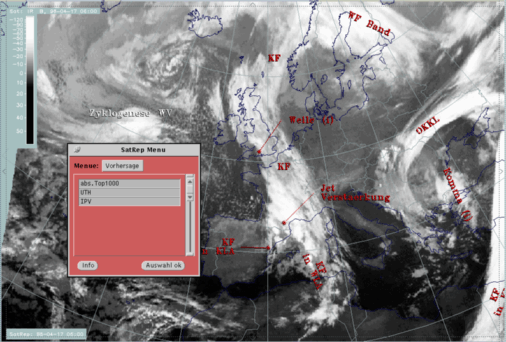
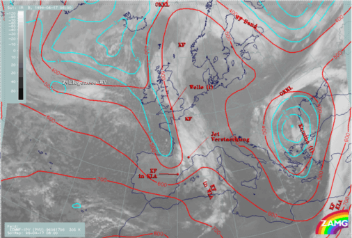
17 April 1996/06.00 UTC - Meteosat IR image; SatRep overlay: names of conceptual models, SatRep menu: key parameters for Cyclogenesis
|
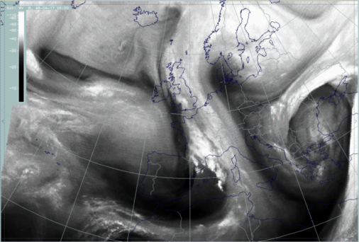
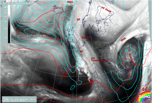
17 April 1996/06.00 UTC - Meteosat WV image
SatRep overlay: names of conceptual models
|
|
|
The satellite image shows a typical configuration for such a development:
- There is a frontal cloud band with a Wave - like bulge consisting of cold cloud tops approximately around 51N/25W.
- Cloudiness with warmer tops emerges from underneath this cloud bulge; in this case this can be recognized around 52N/26-27W.
- In the WV image a Dark Stripe representing very dry air can be found on the cyclonic side of the frontal cloud band up to the area of the cloud bulges described above; often a second more northern Dark Stripe exists at the northern boundary of the lower cloud deck which comes forward below the frontal cloud band.
All three features exist in this special case.
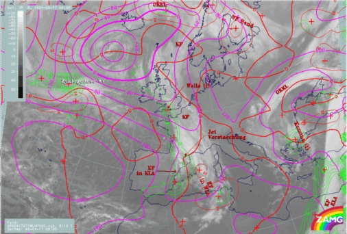
| abs.Top1000 + PVA500>=2 + TA>=0: | This is a commonly used combination of three parameters typically indicative of a wave:
|
|---|---|
| Isot + PVA300>=3: | This is a combination of isotachs greater than 30 units (m sec-1) and positive vorticity advection (PVA) at 300 hPa greater than 3 units (*10-9sec-2) |
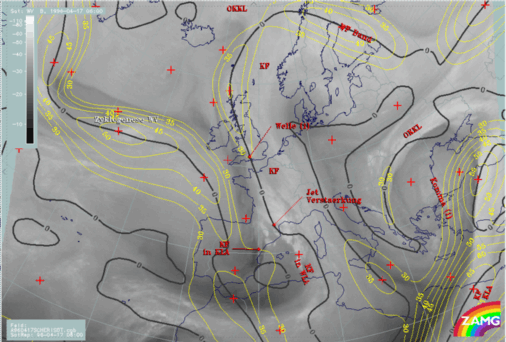
| Isot300 + Scher300=0: | This parameter combination shows the isotachs greater than 30 units (m sec-1) and the zero line of shear vorticity which marks the jet axis; one can get information about the existence and strength of jet streaks and the course of the jet axis |
| PV: | Represents isentropic potential vorticity (*10-6m2sec-1K kg-1) on several levels |
| VQS: | Gives the location of available vertical cross sections (VQS) |
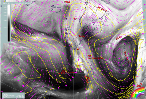
17 April 1996/06.00 UTC - Meteosat IR image; cyan: height contours 1000 hPa, red: temperature advection - WA 1000 hPa, green: positive vorticity advection
(PVA) 500 hPa; SatRep overlay: names of conceptual models
17 April 1996/06.00 UTC - Meteosat WV image; isotachs 300 hPa, black: shear vorticity 300 hPa; SatRep overlay: names of conceptual models
For a further clarification additional key parameters have to be inspected e.g. the PV and relative streams (compare Conceptual Models: Rapid Cyclogenesis - Meteorological physical background ).
|
17 April 1996/06.00 UTC - Meteosat IR image; cyan: potential vorticity (PV) 305K, red: isobars; SatRep overlay: names of conceptual models
|
17 April 1996/06.00 UTC - Meteosat IR image; cyan: potential vorticity (PV) 320K, red: isobars; SatRep overlay: names of conceptual models
|
|
|
|
17 April 1996/06.00 UTC - Meteosat IR image; magenta: relative streams 300 K - system velocity 209° 8 m/s, yellow: isobars; SatRep overlay: names
of conceptual models
|
17 April 1996/06.00 UTC - Meteosat IR image; magenta: relative streams 308 K - system velocity 208° 9 m/s, yellow: isobars; SatRep overlay: names
of conceptual models
|

|
|
One can summarize that this is a situation where the satellite images indicate the initial stages of a Rapid Cyclogenesis which is also represented by most of the key parameters of the numerical model, but the latter is neither correct in position nor in the ability to resolve fine structures.


