09 - 10 APRIL 1996 - MESOSCALE CLOUD BAND: ANALYSIS FOR "SPECIAL INVESTIGATION": 09 APRIL 18.00 UTC TO 10 APRIL 00.00 UTC
by ZAMG
|
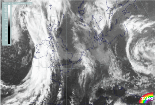
09 April 1996/18.00 UTC - Meteosat IR image
|
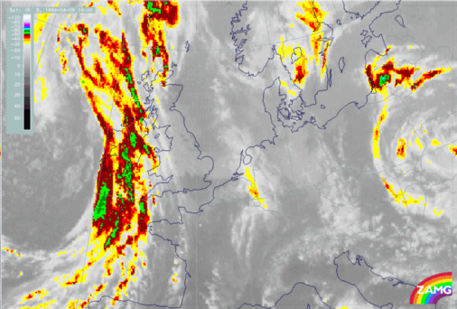
09 April 1996/18.00 UTC - Meteosat IR enhanced image
|
|
|
|
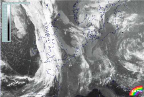
09 April 1996/23.30 UTC - Meteosat IR image
|
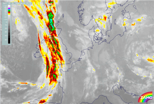
09 April 1996/23.30 UTC - Meteosat IR enhanced image
|
|
|
|
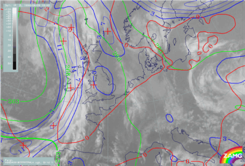
09 April 1996/18.00 UTC - Meteosat IR image; blue: thermal front parameter (TFP) 500/850 hPa, green: equivalent thickness 500/850 hPa, red: temperature
advection - WA 1000 hPa
|
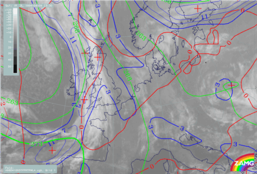
09 April 1996/00.00 UTC - Meteosat IR image; blue: thermal front parameter (TFP) 500/850 hPa, green: equivalent thickness 500/850 hPa, red: temperature
advection - WA 1000 hPa
|
|
|
Summing up, when using the model at this point, it is not possible to classify clearly this cloud band. Therefore to classify this system a vertical cross section through the cloud band must be used.
|
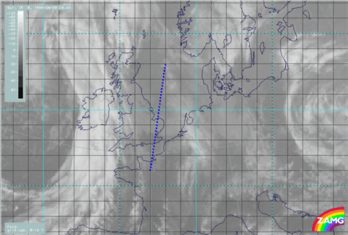
09 April 1996/18.00 UTC - Meteosat IR image; ECMWF grid superimposed; position of vertical cross section indicated
|
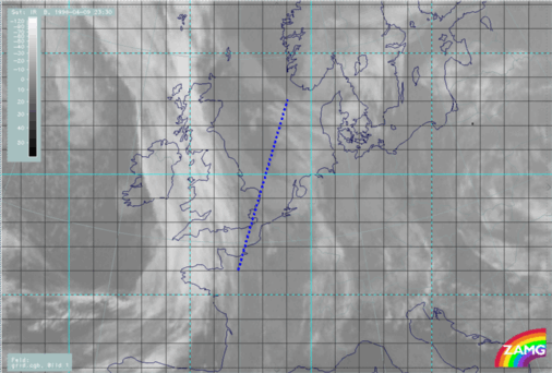
09 April 1996/23.30 UTC - Meteosat IR image; ECMWF grid superimposed; position of vertical cross section indicated
|
|
|
|
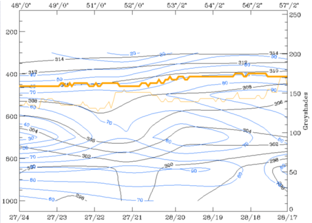
09 April 1996/18.00 UTC - Vertical cross section; black: isentropes (ThetaE), blue: relative humidity, orange thin: IR pixel values, orange thick: WV
pixel values
|
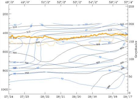
09 April 1996/23.30 UTC - Vertical cross section; black: isentropes (ThetaE), blue: relative humidity, orange thin: IR pixel values, orange thick: WV
pixel values
|
|
|
The right cross section shows the vertical distribution of the equivalent potential temperature and of the relative humidity at 00 UTC. Within this cross section the cloud band is situated between the ECMWF gridpoints of approximately 28/22 and approximately 28/20. In contrast to the cross section at 18.00 UTC, the equivalent potential temperature shows already a weaker crowding zone, especially at the cloud edge which is situated in front of the approaching front (left area within the cross section). This is caused by the continously decreasing area between this small scale cloud band and the frontal cloud band. The result of this process is that the air between both systems is getting warmer and the typical Occlusion - like trough of the isentropes is not as pronounced as within the cross sections at 12 and 18 UTC. The third parameter, the field of relative humidity, shows again high values within the lower layers of the troposphere and lower values within the higher layers.
Summing up, this case study is an example where cross sections are an additional tool to classify, to derive more information or even to gain a better understanding of the meteorological background of weather systems.


