09 - 10 APRIL 1996 - COLD FRONT IN WARM ADVECTION
by ZAMG
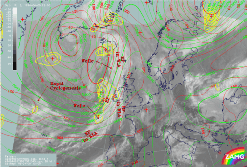
| Front Indicator: | The front indicator indicates the maximum values of the thermal front parameter (TFP) 500/850 hPa (*10-1Km-1) which is an indication for the surface front |
|---|---|
| TFP + rel.Top + TA>=0: | This combination contains the thermal front parameter (TFP) 500/850 hPa greater than 3 units, the equivalent thickness (rel.Top) 500/850 hPa (K) and warm advection 500/1000 hPa (TA>=0) (K 12h-1); this parameter combination contains the information about the thermal situation in the area of the Cold Front |
| TA=>0: | This key parameter shows, as described in the combination above, the thermal situation in the area of the Cold Front |
| Relative Stroeme: | The relative streams show the flow of the relative wind field; this point of view gives more detailed information about the different air masses (like for instance their origin or areas with sinking or rising motion) which are involved in the corresponding meteorological system; in contrast to the parameters described above, which are analyzed on isobaric surfaces, the relative streams show the situation on isentropic surfaces |
| VQS: | The cross section gives a better understanding of the vertical construction of the different meteorological systems; with this parameter the forecaster can locate calculated cross sections (VQS) |
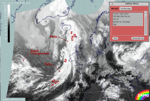
The Cold Front in Warm Advection extends from the Bay of Biscay across north Ireland to east Iceland. The cloud band of the Cold Front is separated into a northern and a southern part by a Wave which is situated above the Atlantic north-west of Scotland at approximately 50N/11W. This Wave will be discussed in more detail within the chapter Wave .
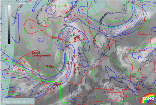
Investigations have shown that on the one hand Cold Fronts in Warm Advection often are not indicated within the model. On the other hand, very often it can be observed that the model does not differentiate between the Cold Front in Warm Advection and the so-called classical Cold Front situated behind. In this case a broad zone of the TFP (extending within the area of the Cold Front in Warm Advection as well as within the classical Cold Front) can be observed. There may be two reasons for this:
- The resolution of the model: the classical Cold Front and the Cold Front in Warm Advection are situated very close to each other; since the model has a grid distance of 150 km, this can be the reason for the missing separation between both frontal systems.
- The missing temperature contrast of the air situated in front of and behind the Cold Front in Warm Advection resulting in little or no temperature gradient.


