18 - 19 FEBRUARY 1996 - FORECAST FOR THE ENHANCED CUMULUS FOR 18 FEBRUARY 12.00 UTC AND 18.00 UTC
by ZAMG
18 February 1996/06.00 UTC - Meteosat IR image; SatRep overlay: names of conceptual models; yellow: positive vorticity advection (PVA) 500 hPa 06.00 UTC,
green: positive vorticity advection (PVA) 500 hPa 12.00 UTC, blue: positive vorticity advection (PVA) 500 hPa 18.00 UTC
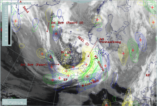
Comparing with the images, this is not verified completely because there is an area of enhanced cells which propagates from Ireland at 06.00 UTC to central England at 12.00 and the Netherlands at 18.00 UTC.
|
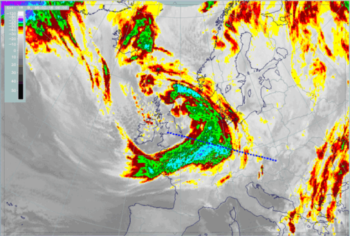
18 February 1996/06.00 UTC - Meteosat IR enhanced image; position of vertical cross section indicated
|
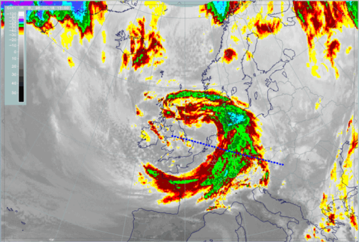
18 February 1996/12.00 UTC - Meteosat IR enhanced image; position of vertical cross section indicated
|
|
|
|
|
|
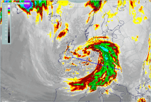
18 February 1996/18.00 UTC - Meteosat IR enhanced image; position of vertical cross section indicated
|


