Please use the following links for details:
Project Summary
Scientific / tecnical objecives and innovation
Project Workplan
Project Partners
Project Milestones
Project Summary of ALP-IMP
 |
 |
 |
 |
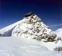
| Observatory at Sonnblick © dig. Glacier Archive, ZAMG |
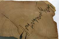
Tree-ring example © K. Nicolussi |
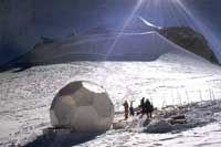
Drill site at Mt. Blanc © U. Ruth |
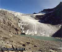
Fleißkees 1983 © dig. Glacier Archive, ZAMG |
- Problems to be solved
A good documentation and analysis of observed climate variability and change serves to define the margins of natural variability for the projections of future climate change based on model output. In addition it may serve to possibly detect and quantify an already existing anthropogenic signal in the observed data. Especially concerning the regional to local scale we do not heave a consistent picture of observed climate variability yet. The still existing lacks are due to the not yet adequate and full use of the existing data potential (instrumental and proxy both in terms of length, spatial density and quality), to attempts of combined analysis of instrumental and proxy data and to integrate it with high resolution climate modeling. Regional modeling has reached a point now where even complicated terrain may adequately be handled – thus being able to supplement and complete our understanding of regional climate variability and change.
Using the Alps as study region is a challenge and a chance:
A challenge because of the complicated topography which causes complicated climate variability patterns in all three spatial components
A chance because of the unique instrumental data there (spatial density, length and quality in terms of homogeneity) and because of the Alpine–specific proxies existing in a mountainous area (climate sensitive tree-ring data from the vertical tree-line and from regions with humidity stress, ice core information from high elevation cold glaciers and high resolution and well studied glacier variability data) which provide the possibility to extend the time scale from two centuries to one millennium. - Scientific objecives and approach
ALP-IMP will use the unique data potential existing in the “Greater Alpine Region” (GAR) to produce a consistent picture of regional climate variability in the region for the following time scales:
The last 50 years (highest resolution instrumental data plus HR-regional modeling)
The last 150 to 250 years (upscaling of the scarcer long-term instrumental information by linking it to the mesoscale patterns from the 50 years HR model run, analyze them and compare them to continental and global patterns)
The last 1000 years (using the derived results for the instrumental period as comparative period for proxy modeling of climate variability of the last millennium and a combined analysis of the results for internal climate variability patterns within the study region and in comparison with continental to global scale features).
- Expected impacts
The first major output of the project is a number of quality checked and consistency tested instrumental and proxy datasets in the study region which have not existed yet, neither for the Alps nor for any other mountainous region of the world. They have a strong potential for a wide spectrum of applications within the scientific climate variability- and also for the climate impact community. Most of climate impacts are interesting at local scale mainly which makes the mesoscale approach of the project especially valuable for such questions.
The second is a better understanding of climate variability patterns in complicated terrain – including also the vertical component for which the high-alpine observatories and the high-alpine proxies will produce information not available elsewhere. This may serve as an assessment of the spatial representativity and the possibility to extrapolate climate variability results from regions with scarce data coverage.
The third is a better understanding of the position of the Alpine in the frame of the continental scale European climate variability and the impact of the Alps on European scale variability features. Most of the global climate model results postulate the Alps to be an inversion zone between different climate evolutions. A closer look at high spatial resolution will contribute to clarify those gradients.
Scientific / technical objectives and innovation
Actual climate change research has made considerable progress in understanding the physical background of the global climate system and in developing methods to estimate future climate development under the influence of anthropogenic forcing. It is evident that any finding on current and future anthropogenic influence has to be assessed against the background of natural climate variability. Taking into account the increasing capability of climate models to resolve smaller scales there is an increasing demand on understanding past climate variability in higher spatial resolution as well.The European Alps and their surroundings (hence designated GAR – “Greater Alpine Region”) have a unique potential to be used as a study region to fill existing gaps in our knowledge of the regional features of climate variability due to the following arguments:
The “Greater Alpine Region” stands out through
- Unique (in terms of length and spatial density) but not yet adequately and systematically exploited climate data potential (instrumental and proxy)
- proxies that are typical for mountain-regions (tree-rings from the tree-line, ice cores from cold glaciers, glacier variations)
- small scale climate variability patterns interesting for statistical and model supported studies
- being a sharp “climate divide” in continental scale in the transitional zone between Atlantic, continental and Mediterranean influences
- having “vertical potential” with instrumental and proxy data from 0 to 4500m asl. - in many cases from remote places (“climate background sites”) – thus covering not only surface-near climate but also the lower troposphere
- having a high climate change sensibility (Alpine DT 1890-2000 = 2 times DT global)
- being highly sensitive for climate impacts (e.g.: topographical enhanced water cycle plus steep topography resulting in flooding, debris flows, avalanches, or vertical plant migration and others)
ALP-IMP is going to use the described research potential of the greater Alpine region by:
Collecting, completing, evaluating, validating and understanding the existing information on millennium scale climate variability in the “Greater Alpine Region” within the project and to provide the integrated GAR dataset as well as the project’s findings ready for use in the public domain for further climate and climate impact studies.
This general task will be headed for by the following objectives of the project:
- To extend the instrumental climate database in the greater Alpine region to high spatial density, to the maximum possible length and to add important climate elements to the main elements mean temperature and precipitation which are already available from a previous EU-project (105) – thus creating a multiple instrumental dataset adequate to cope with the needs of understanding the climate system.
- To remove non climatic inhomogeneities from the instrumental series using a state of the art approach based on statistical testing and intensive use of metadata from station history.
- To extend the database by several additional centuries through the integration of the typical Alpine proxy data sources (tree rings, stable water isotopes from Alpine ice cores, glacier variability) to a homogeneous and consistent data archive describing climate variability, outstanding periods, abrupt climate changes in the Alpine realm – covering also the two controversial periods of a Medieval Climate Optimum and the flickering climate of the Little Ice Age – which define the baseline for potential anthropogenic changes.
- To test the consistency of the GAR dataset with existing other (continental to global scale) datasets and versus backward model simulations for the Alps in high spatial resolution (both in horizontal and in vertical aspect)
- To analyze the dataset for regional climate variability patterns within the topographically complicated study region and set them into the context of continental to hemispheric patterns.
- To use sophisticated statistical methods and high resolution mesoscale regional climate modeling to understand the observed climate variability in the study region under the aspect of natural and/or anthropogenic forcing
- To study climate impact on the cryosphere in the Alps (being of limiting influence on winter-tourism which is among the leading economic factors in the region)
Thus the project will exploit major parts of the specific data potential of the GAR region and draw a comprehensive picture of climate variability of the last 500 to 1000 years and define the frame of reference of natural variability to better assess the mechanisms and the quantitative patterns of future possible changes in the topographically complicated study region.
The Alps - with their unique climate data - provide great chances to cope with this task and their complicated topography and their geographical situation in the transitional zone of different continental scale climate regions are an appropriate challenge for modern climate research.
Project Workplan
The project's activities are broadly divided into three worktasks (WT) which reflect the main temporal and also the methodological structure of the project.| 1: Data Worktask Establishes the database of climate variability in the greater Alpine region (GAR) |
|||
| WP-1 instrumental database |
WP-2 tree ring proxies |
WP-3 ice core proxies |
WP-4 glacier proxies |
| 2: Consistency Worktask Tests the consistency of the GAR database |
|
| WP-5 Observed vs. observed internal intervariable consistency and external consistency (GAR vs. large scale) |
WP-6 observed vs. model simulated identifying and understanding consistency or inconsitency of GAR data with model simulations |
| 3: Synthesis Worktask Performs an integrated climate variability analysis of GAR for the instrumental period (~200 years) in WP-7 and WP-8 |
|||||
| WP-7 Internal climate variability analysis in the GAR |
WP-8 GAR climate variability analyzed vs. large scale features |
||||
| for the last millennium in WP-9 | |||||
| WP-9 The proxy-period |
|||||