AVALANCHE CATASTROPHE 05 - 25 FEBRUARY 1999 - DETACHED WARM FRONT AND SUBTYPES
by ZAMG
- Detached Warm Front crosses the Alpine region accompanied by a distinct thickness gradient
- WA maximum crosses the region
- PVA mostly existing but impact not clear
- Main cloud features: Detached Warm Front cloud, Warm Front fibres, Stau features
Two main cases have been selected: the 18 February 06.00 and 12.00 UTC and the 24 February 12.00 UTC. For the complete sequence of satellite images during this phase see Overview - Phase 6 and Overview - Phase 11 .
|
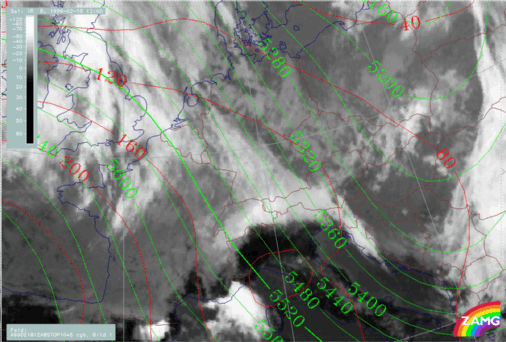
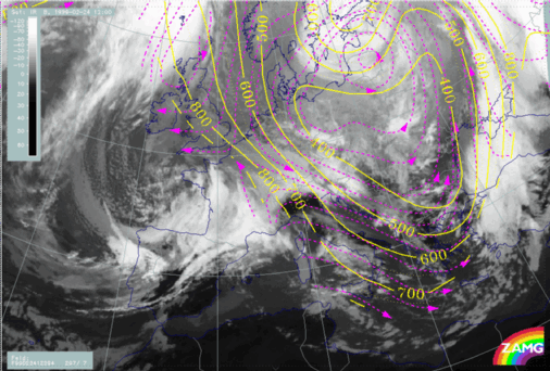
18 February 1999/06.00 UTC - Meteosat IR image; red: height contours 1000 hPa, green: height contours 500 hPa
|
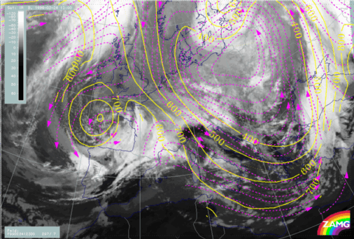
18 February 1999/12.00 UTC - Meteosat IR image; red: height contours 1000 hPa, green: height contours 500 hPa
|

|
|
|
|
|
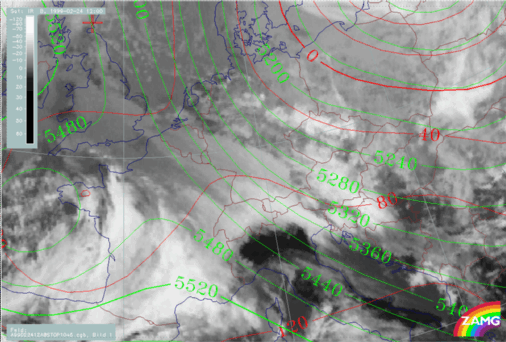
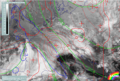
24 February 1999/12.00 UTC - Meteosat IR image; red: height contours 1000 hPa, green: height contours 500 hPa
|
A distinct common feature can be found in the upper level height field in the form of a strong broad NW flow to the rear of an upper level trough over the Balkan Peninsula or even further east. The surface field varies somewhat between the different examples, but there is no surface low. On the contrary, a surface ridge is present in the area of the Alps.
|
18 February 1999/06.00 UTC - Meteosat IR image; green: equivalent thickness 500/1000 hPa, red solid: temperature advection - WA 700 hPa, red
dashed: temperature advection - CA 700 hPa, blue: Thermal Front Parameter (TFP)
|
18 February 1999/12.00 UTC - Meteosat IR image; green: equivalent thickness 500/1000 hPa, red solid: temperature advection - WA 700 hPa, red
dashed: temperature advection - CA 700 hPa, blue: Thermal Front Parameter (TFP)
|
|
|
|
|
|
24 February 1999/12.00 UTC - Meteosat IR image; green: equivalent thickness 500/1000 hPa, red solid: temperature advection - WA 700 hPa, red
dashed: temperature advection - CA 700 hPa, blue: Thermal Front Parameter (TFP)
|
|
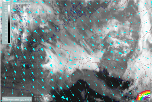
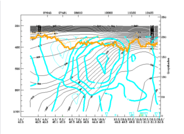
18 February 1999/06.00 UTC - Meteosat IR image; cyan: wind vectors 850 hPa
|
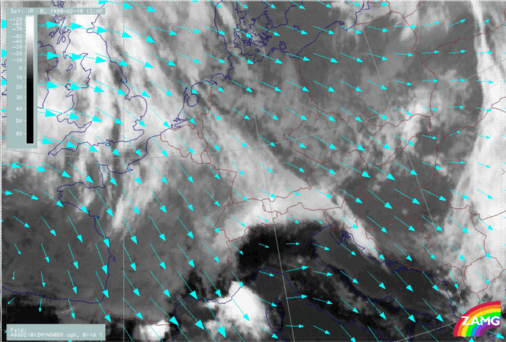
18 February 1999/12.00 UTC - Meteosat IR image; cyan: wind vectors 850 hPa
|
|
|
|
|
|
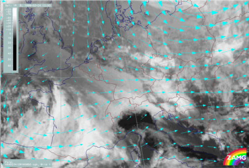
24 February 1999/12.00 UTC - Meteosat IR image; cyan: wind vectors 850 hPa
|
|
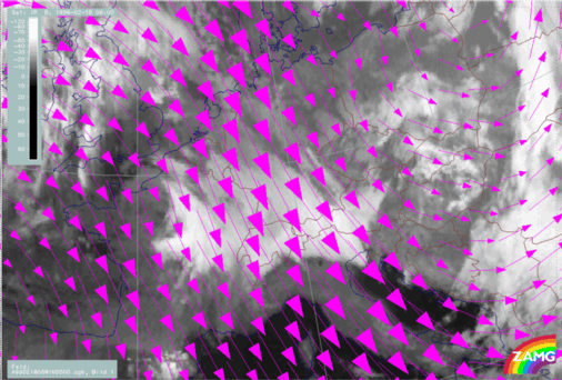
18 February 1999/06.00 UTC - Meteosat IR image; magenta: wind vectors 500 hPa
|
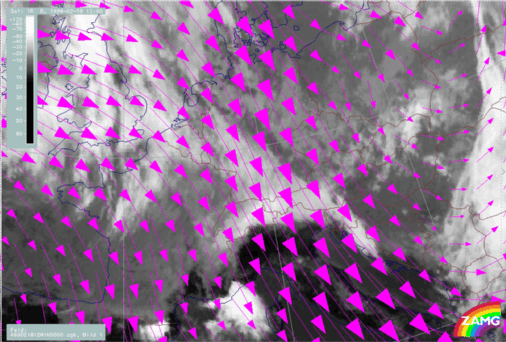
18 February 1999/12.00 UTC - Meteosat IR image; magenta: wind vectors 500 hPa
|
|
|
|
|
|
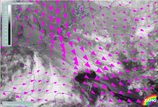
24 February 1999/12.00 UTC - Meteosat IR image; magenta: wind vectors 500 hPa
|
The wind fields at 850 hPa are not as easy to compare as for the high levels, but there is a tendency for NW components.
|
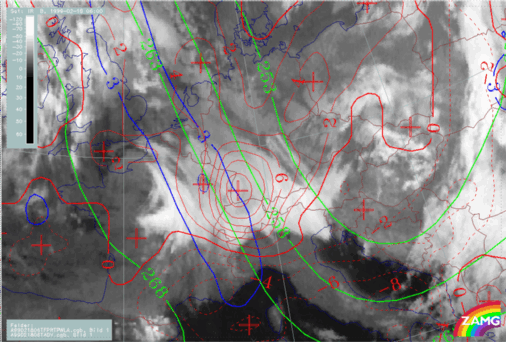
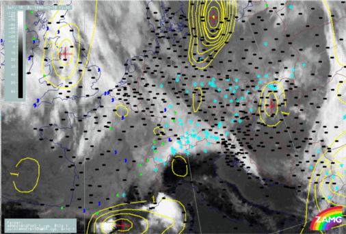
18 February 1999/06.00 UTC - Meteosat IR image; yellow: positive vorticity advection (PVA) 500 hPa; weather events (green: rain and showers, blue:
drizzle, cyan: snow, red: thunderstorm with precipitation, purple: freezing rain, orange: hail, black: no actual precipitation or thunderstorm with
precipitation)
|
18 February 1999/12.00 UTC - Meteosat IR image; yellow: positive vorticity advection (PVA) 500 hPa; weather events (green: rain and showers, blue:
drizzle, cyan: snow, red: thunderstorm with precipitation, purple: freezing rain, orange: hail, black: no actual precipitation or thunderstorm with
precipitation)
|
|
|
|
|
|
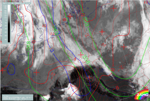
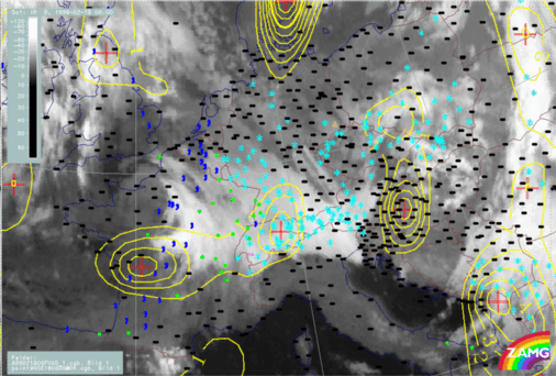
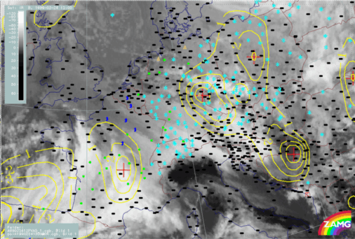
24 February 1999/12.00 UTC - Meteosat IR image; yellow: positive vorticity advection (PVA) 500 hPa; weather events (green: rain and showers, blue:
drizzle, cyan: snow, red: thunderstorm with precipitation, purple: freezing rain, orange: hail, black: no actual precipitation or thunderstorm with
precipitation)
|
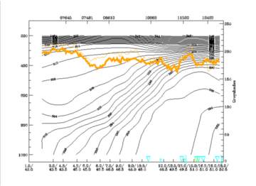
The intensity of the Detached Warm Front can be demonstrated with the help of vertical cross sections. As results are very similar for the different cases, the case of 24 February is chosen as an example. The vertical cross section line is oriented from SW to NE and is perpendicular to the Detached Warm Front cloud immediately north of the Alps. In the south-westernmost part some cloudiness belonging to a succeeding system is also present.
|
24 February 1999/12.00 UTC - Meteosat IR image; position of vertical cross section indicated
|
24 February 1999/12.00 UTC - Vertical cross section; black: isentropes (ThetaE), orange thin: IR pixel values, orange thick: WV pixel values
|

|
|
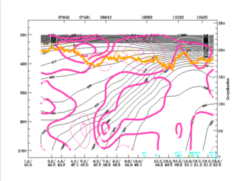
So, concluding from these different parameters one can say that Detached Warm Fronts are very well marked in the vertical cross section. In this special case the surface frontal layer shows some signs of dissipation.
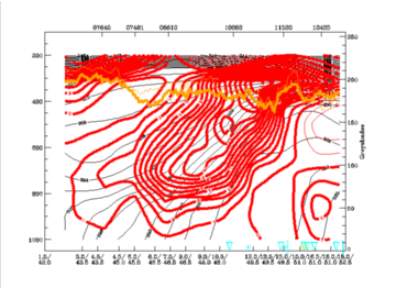
Relative streams on two isentropic surfaces within the frontal surface (294K and 300K) reveal that Detached Warm Fronts are somewhat different from classical Warm Fronts.
|
24 February 1999/12.00 UTC - Meteosat IR image; magenta: relative streams 294K - system velocity 297° 7 m/s; yellow: isobars
|
24 February 1999/12.00 UTC - Meteosat IR image; magenta: relative streams 300K - system velocity 297° 7 m/s; yellow: isobars
|
|
|


