AVALANCHE CATASTROPHE 05 - 25 FEBRUARY 1999 - CLASSICAL WARM FRONT SHIELDS
by ZAMG
- Warm Front crosses the Alpine region accompanied by a distinct thickness gradient
- WA maximum crosses the region
- Main cloud features: Warm Front cloud shield
Two main cases have been selected: the 19 February 12.00 UTC and the 21 February 12.00 UTC. For the complete sequence of satellite images during this phase see Overview - Phase 6 and Overview - Phase 8 .
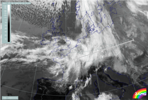
The cloud features differ quite distinctly from those of the Detached Warm Front. There are more extended Warm Front cloud shields which are linked to a Cold Front system. During this catastrophic phase, double structures of Warm Front Shields could very often be observed and which developed from the merging of several systems. Cloudiness is fibrous and Stau Cloud features are not so apparent in the IR images. Both situations are observed: The ending of the fibres at the highest mountain chain as well as an overflow of cloud into the southern regions of the Alps.
|
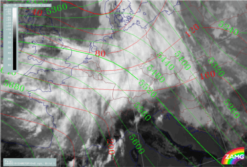
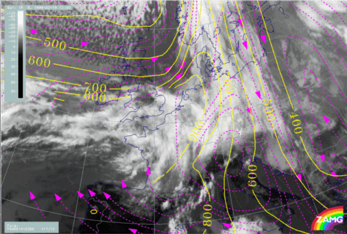
19 February 1999/12.00 UTC - Meteosat IR image; red: height contours 1000 hPa, green: height contours 500 hPa
|
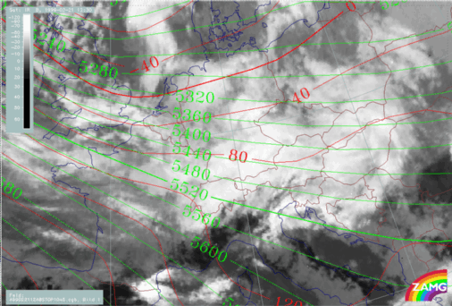
21 February 1999/12.30 UTC - Meteosat IR image; red: height contours 1000 hPa, green: height contours 500 hPa
|
|
|
|
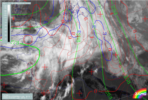
19 February 1999/12.00 UTC - Meteosat IR image; green: equivalent thickness 500/1000 hPa, red solid: temperature advection - WA 700 hPa, red
dashed: temperature advection - CA 700 hPa, blue: Thermal Front Parameter (TFP)
|
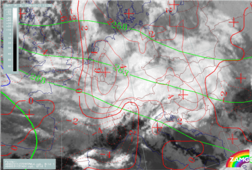
21 February 1999/12.30 UTC - Meteosat IR image; green: equivalent thickness 500/1000 hPa, red solid: temperature advection - WA 700 hPa, red
dashed: temperature advection - CA 700 hPa, blue: Thermal Front Parameter (TFP)
|
|
|
|
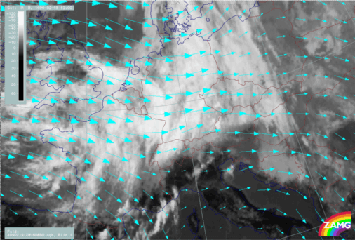
19 February 1999/12.00 UTC - Meteosat IR image; cyan: wind vectors 850 hPa
|
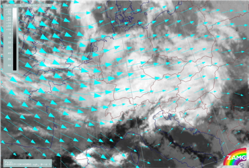
21 February 1999/12.30 UTC - Meteosat IR image; cyan: wind vectors 850 hPa
|
|
|
|
|
|
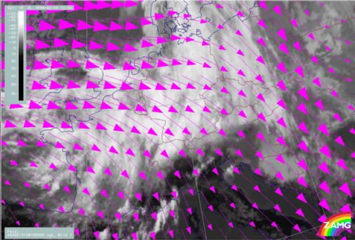
19 February 1999/12.00 UTC - Meteosat IR image; magenta: wind vectors 500 hPa
|
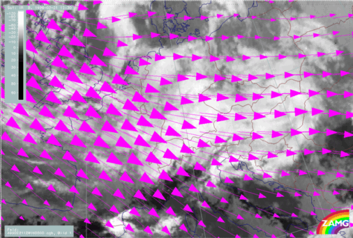
21 February 1999/12.30 UTC - Meteosat IR image; magenta: wind vectors 500 hPa
|
|
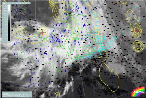
19 February 1999/12.00 UTC - Meteosat IR image; yellow: positive vorticity advection (PVA) 500 hPa; weather events (green: rain and showers, blue:
drizzle, cyan: snow, red: thunderstorm with precipitation, purple: freezing rain, orange: hail, black: no actual precipitation or thunderstorm with
precipitation)
|
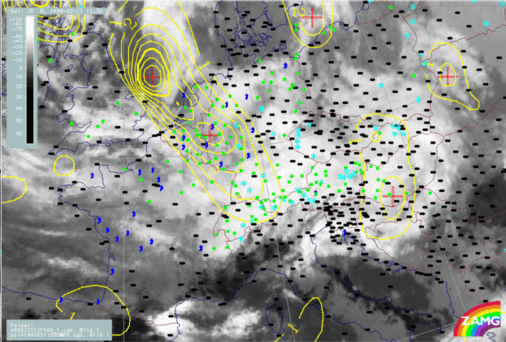
21 February 1999/12.30 UTC - Meteosat IR image; yellow: positive vorticity advection (PVA) 500 hPa; weather events (green: rain and showers, blue:
drizzle, cyan: snow, red: thunderstorm with precipitation, purple: freezing rain, orange: hail, black: no actual precipitation or thunderstorm with
precipitation)
|
|
|
|
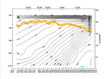
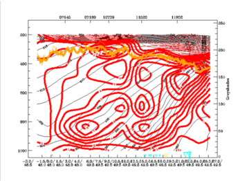
19 February 1999/12.00 UTC - Vertical cross section; black: isentropes (ThetaE), red thin: temperature advection - CA, red thick: temperature
advection - WA, orange thin: IR pixel values, orange thick: WV pixel values
|
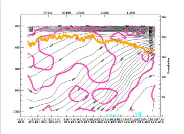
19 February 1999/12.00 UTC - Vertical cross section; black: isentropes (ThetaE), magenta thin: divergence, magenta thick: convergence, orange thin:
IR pixel values, orange thick: WV pixel values
|
|
|
|
|
|
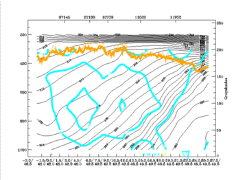
19 February 1999/12.00 UTC - Vertical cross section; black: isentropes (ThetaE), cyan thick: vertical motion (omega) - upward motion, cyan thin:
vertical motion (omega) - downward motion, orange thin: IR pixel values, orange thick: WV pixel values
|
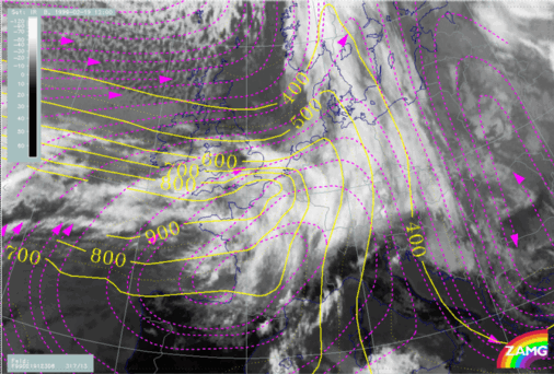
Relative streams are computed for 300K and 306K. The lower surface is a transition between the two frontal surfaces, the higher one belongs to the western Warm Front Shield.
|
19 February 1999/12.00 UTC - Meteosat IR image; magenta: relative streams 300K - system velocity 317° 13 m/s; yellow: isobars
|
19 February 1999/12.00 UTC - Meteosat IR image; magenta: relative streams 306K - system velocity 317° 13 m/s; yellow: isobars
|
|
|

