FLOOD CATASTROPHE 10 - 13 AUGUST 2002 - INTITIAL SITUATION: INTRUSION OF COLD AIR INTO THE WESTERN MEDITERRANEAN
by ZAMG
Cloud systems in the initial weather situation
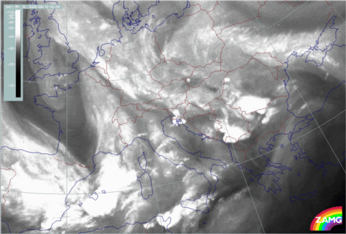
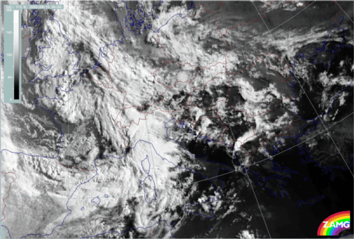
The change from the initial situation to the second flood situation can be seen in the sequence of satellite images below (IR, WV and VIS) for the 10th of August. Several processes of meso-scale Wave development and cloud enhancement are involved in the whole process.
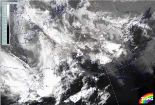
- A spiral structure over the W. Alps and NW Italy, best seen at 15.00 UTC; from then on the spiral decays;
- A spiral forms later over Sardinia, best seen between 18.00 and 21.00 UTC.
- The main intrusion of dry air (black in WV) is into the NW Mediterranean (Gulf of Lyon); for this development the spiral structure is not as distinct in the WV as it is in the IR image; the dark area is best seen at 15.00 UTC.
- The second area of dry air (Dark Stripe) moves from the Gulf of Biscay across N. Spain and the Balearic Islands to Sardinia; for this development the spiral is very clear, even in the WV image (best between 18.00 - 21.00 UTC)
- The spiral structure over NW Italy is very visible in the VIS images from 12.00 UTC;
- The second spiral over Sardinia starts with a broadening area west of Sardinia at 12.00 UTC and develops into a distinct spiral at 18.00 UTC.
Initial weather situation: relevant numerical parameters
The loops of relevant numerical parameters, such as frontal and upper level parameters, help to clarify the initial situation on the 10th of August. The different meso-scale processes of Wave development and cloud enhancement seen in the satellite imagery can also be identified in the model fields below.
10 August 2002/00.00 UTC - Meteosat IR image; blue: thermal front parameter (TFP) 500/850 hPa, green: equivalent thickness 500/850 hPa
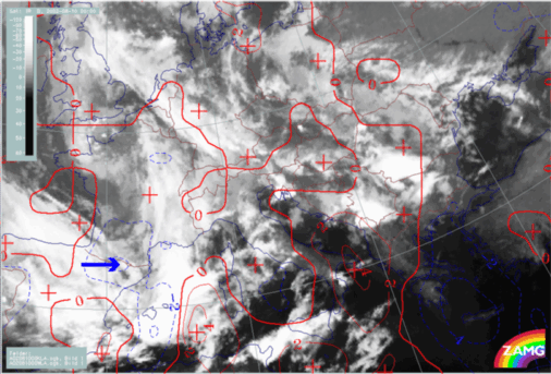
10 August 2002/00.00 UTC - Meteosat IR image; red: temperature advection - WA 1000 hPa, blue: temperature advection - CA 1000 hPa
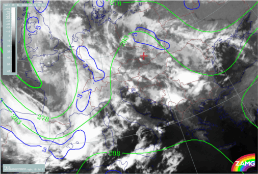
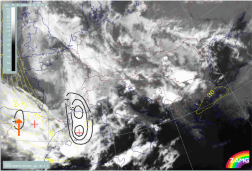
10 August 2002/00.00 UTC - Meteosat IR image; black: positive vorticity advection (PVA) 300 hPa, yellow: isotachs
- Between 00.00 and 06.00 UTC a PVA max lies in the left exit region of a NW-SE orientated jet streak (N. Spain - Balearic Islands); the PVA Maximum moves from the Gulf of Lyon to the Gulf of Genoa and is accompanied by intensifying cloud in this area (this is ahead of the spiral development over N. Italy); from 12.00 UTC this feature vanishes
- From 12.00 UTC a new PVA maximum in the left exit region of a NW-SE orientated jet streak (N. Spain - Balearic Islands) appears and moves to Sardinia and Corsica. This one is accompanied by intensifying cloud, and is a precursor of the second, southern cloud spiral over Sardinia.
10 August 2002/00.00 UTC - Meteosat WV image; magenta: height of PV = 2 units
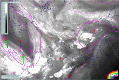
- Moving from the Pyrenees into the Gulf of Lyon
- Moving from the Gulf of Biscay to the W. Pyrenees
10 August 2002/00.00 UTC - Meteosat IR image; magenta: height contours 1000 hPa
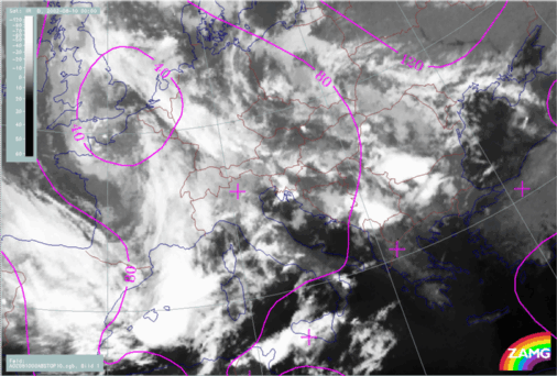
- At 06.00 UTC only a small surface low develops over NW Italy; this corresponds to the northern cloud spiral in the satellite image, as well as to other relevant parameters
- From then the area of surface low is extending to the S, forming an area comprising both spiral developments (NW-Italy and Sardinia).


