FLOOD CATASTROPHE 06 - 08 AUGUST 2002 - FLOODPHASE
by ZAMG
Sequence of weather: Rain amounts
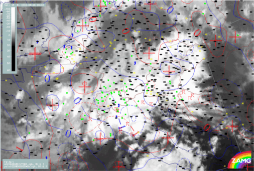
Development Phase: 06 August 02/06.00 - 18.00 UTC
06 August 2002/06.00 UTC - Meteosat IR image; weather events (green: rain and showers, blue: drizzle, cyan: snow, red: thunderstorm with
precipitation, purple: freezing rain, orange: hail, black: no actual precipitation or thunderstorm with precipitation)
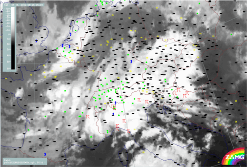
Flood Phase: 07 August 02/00.00 - 08 August 02/12.00 UTC
07 August 2002/00.00 UTC - Meteosat IR image; weather events (green: rain and showers, blue: drizzle, cyan: snow, red: thunderstorm with
precipitation, purple: freezing rain, orange: hail, black: no actual precipitation or thunderstorm with precipitation)
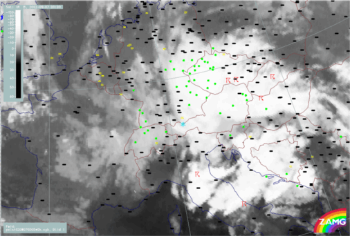
Thunderstorms develop during whole period but they mainly form in specific areas of the occluded cloud spiral:
- In the S: Italy and (later) Bosnia
- To the NE in Czech Republic
- And later: in Germany in the area of the old main ULL
Precipitation amounts in pre-flood and flood phase
06 August 2002/06.00 UTC - Meteosat IR image; blue: 6-hourly precipitation amounts (thick line: 1mm, isoline distance: 4mm); magenta: areas with
insufficient data coverage
Relationship of precipitation with relevant parameters
The loops below show the relationship of weather events with relevant numerical parameters, such as wind fields and convergence. The first clearly demonstrates the enhancement of weather activity by Stau effects, the latter show the dramatic effect of convergence, with an intensity and duration seldom seen in other cases.
Wind fields at 850 and 500 hPa
06 August 2002/06.00 UTC - Meteosat IR image; weather events (green: rain and showers, blue: drizzle, cyan: snow, red: thunderstorm with
precipitation, purple: freezing rain, orange: hail, black: no actual precipitation or thunderstorm with precipitation); red: wind vectors at 850 hPa
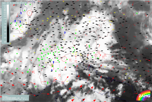
During the period under discussion the centre of the cyclonic rotation moves from SE Austria and W. Hungary to the east across N. Croatia and Jugoslavia to Romania. Consequently the whole area of the Czech Republic and N,NE Austria is under a N to NE stream which produces the Stau effects over the Czech and Alpine mountains.
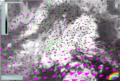
06 August 2002/06.00 UTC - Meteosat IR image; weather events (green: rain and showers, blue: drizzle, cyan: snow, red: thunderstorm with
precipitation, purple: freezing rain, orange: hail, black: no actual precipitation or thunderstorm with precipitation); magenta: wind vectors at 500
hPa
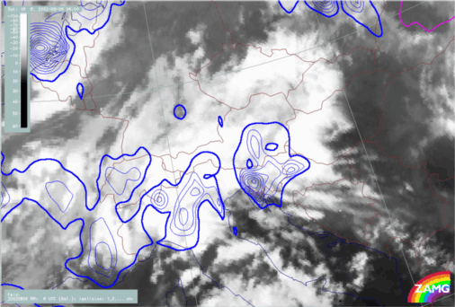
Fields of Divergence at 850 and 700 hPa
06 August 2002/06.00 UTC - Meteosat IR image; weather events (green: rain and showers, blue: drizzle, cyan: snow, red: thunderstorm with
precipitation, purple: freezing rain, orange: hail, black: no actual precipitation or thunderstorm with precipitation); blue: thermal front
parameter 500/850 hPa; red: divergence 850 hPa (red dashed: convergence); blue: divergence 700 hPa (blue dashed: convergence)