FLOOD CATASTROPHE 06 - 08 AUGUST 2002 - DEVELOPMENT OF GENOA CYCLONE
by ZAMG
Development of a Genoa Cyclone in satellite imagery
The IR, WV and VIS image loops shown below show the phases of development of a Mediterranean low in the Gulf of Genoa.
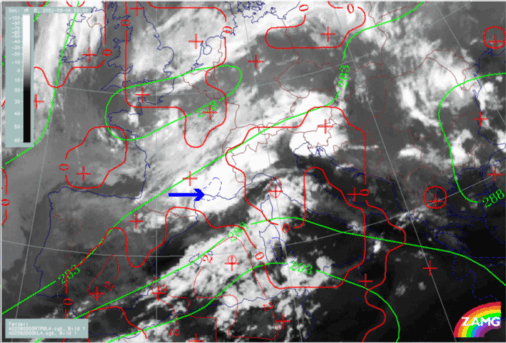
06 August 2002/00.00 UTC - Meteosat IR image
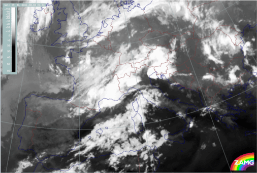
In the first of development (approx. 00.00 - 03.00 UTC) convective clouds are developing between the two baroclinic cloud bands which are near Italy. Consequently, a connection between the two cloud bands takes place, leading to the impression of a Cold Front (the former southern cloud band) and an Occlusion spiral (the former northern band).
But the main process takes place from 03.00 UTC, with the development of cyclonic rotation in the area between Corsica and Genoa. This rotation produces to a cloud spiral and is accompanied by the development of huge convective cells and extensive MCS. The spiral moves NNE.
From 15.00 UTC, a new development of MCSs takes place over the Gulf of Genoa. This is to the rear of the cloud system responsible for the flood and, consequently, (although it is a very interesting feature) it is not directly connected to the flood situation and is not studied further here.
06 August 2002/00.00 UTC - Meteosat WV image
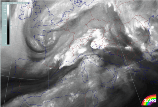
The development seen in the IR loop can also be followed in the above WV loop. Additionally, distinct Dark Stripes can be recognised accompanying the development.
As is often observed, convective cells develop at the end of the Dark Stripe (over Gulf of Genoa and mid Italy). From 07.00 UTC a splitting of the Dark Stripe takes place with:
- One branch overrunning the southerly system and extending into Bosnia
- Another branch remains to the rear of the spiral over Italy, indicating the initiation of cyclogenesis by processes at higher levels.
06 August 2002/06.00 UTC - Meteosat VIS image
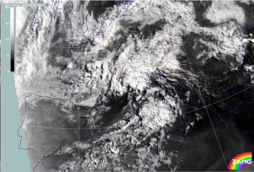
The loop of VIS images above shows the development of the spiral structure very well but the most impressive features are the developing MCSs.
The development of the Genoa cyclone in the relevant model fields
The contribution of relevant numerical parameters, such as height contours, winds and temperature advection, to the development of a Mediterranean low in the Gulf of Genoa can be evaluated from the loops shown below.
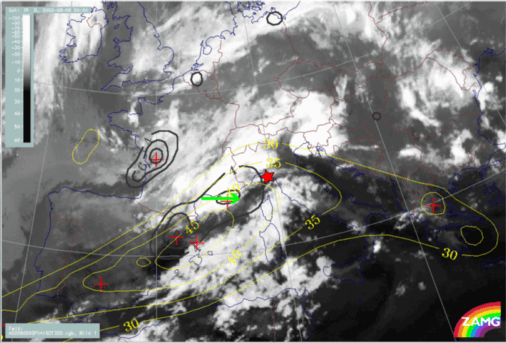
06 August 2002/00.00 UTC - Meteosat IR image; magenta: height contours 1000 hPa, blue: wind vectors 850 hPa
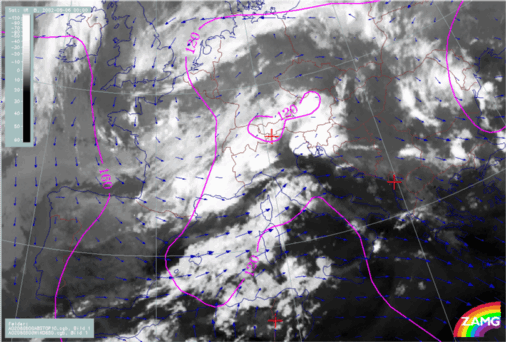
Initially, there are only weak gradients at surface levels (1000 hPa); later, the development of a surface low over N. Italy and the Adriatic Sea can be observed which is increasing in size: to the NE and SE as well as to the W (Gulf of Genoa). At the same time a cyclonic circulation develops at 850 hPa over the W. Alps and moves eastward.
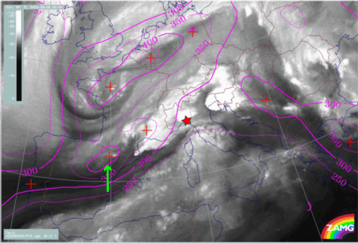
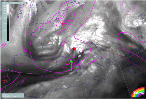
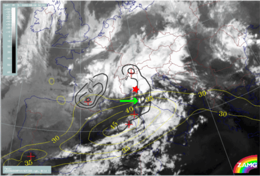
The role of physical processes at upper levels, such as potential vorticity and vorticity advection, in triggering the development of a Mediterranean low in the Gulf of Genoa, is demonstrated with the images below.
If the same area (red star) is studied from the viewpoint of jets streaks and PVA maxima, this area is identical with the one where there was intensification by PVA in the left exit region of a jet streak (green arrows in the two lower images).