FLOOD CATASTROPHE 06 - 08 AUGUST 2002 - INITIAL WEATHER SITUATION
by ZAMG
Cloud systems in the initial weather situation
|
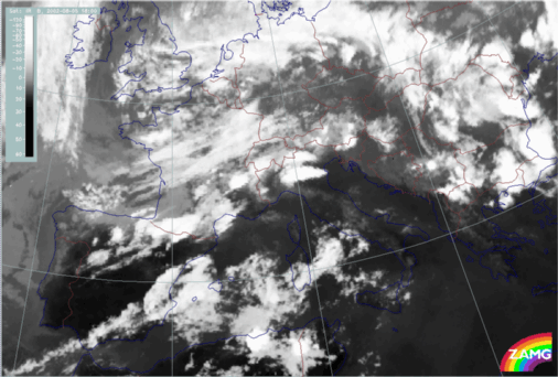
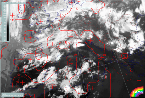
05 August 2002/18.00 UTC - Meteosat IR image
|
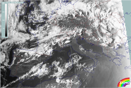
05 August 2002/17.00 UTC - Meteosat VIS image
|
|
|
|
|
|
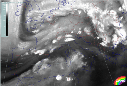
05 August 2002/18.00 UTC - Meteosat WV image
|
The above Meteosat images, in the three spectral channels, show the cloud systems at the initial stage of the first flood event in August 2002:
While there are only very weak pressure gradient at surface levels (1000 hPa), an intensive Upper Level Low (ULL) dominates at a height of 500 hPa with its centre over Belgium and an upper level trough extending from Brittany to N. Spain.
Pronounced upper level features are involved in the weather situation; they are indicative of developments triggered by processes taking place in the middle and upper troposphere:
There are two synoptic scale cloud bands:
- The northern one extends from N. Spain across France and Switzerland to Austria. Many MCSs are embedded along its southern boundary; they are very well developed and have a high vertical extent. The future development of the flood situation takes place largely as a result of this cloud band, which represents a warm and highly unstable air mass.
- The southern band extends from S. Spain across the western Mediterranean and Sardinia to mid Italy.
The images also show a distinct cloud spiral to the north:
- The main spiral can be found over Belgium and Germany
- A secondary spiral shows up as a Dark Stripe in WV imagery over Brittany; it is well recognisable and shows features which indicate further development.
Synoptic Situation and air mass characteristics
|
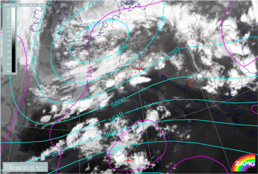
05 August 2002/18.00 UTC - Meteosat IR image; magenta: height contours 1000 hPa, cyan: height contours 500 hPa
|
05 August 2002/18.00 UTC - Meteosat IR image; red: temperature advection 700 hPa
|
|
|
|
|
|
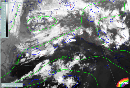
05 August 2002/18.00 UTC - Meteosat IR image; blue: thermal front parameter (TFP) 500/850 hPa, green: equivalent thickness 500/850 hPa
|
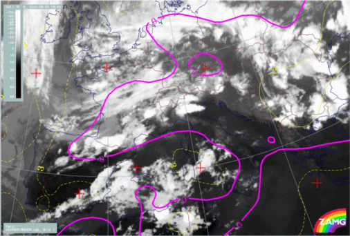
05 August 2002/18.00 UTC - Meteosat IR image; magenta, yellow: Showalter index
|
Two baroclinic zones - represented by a high gradient of thickness and a TFP, but only weak temperature advection - are associated with the two cloud bands.
In the image including Showalter index, values of < 3 indicate an unstable air mass, but it is even more unstable near the northern Baroclinic Boundary which contains many MCSs and is accompanied by a Showalter index < 0.
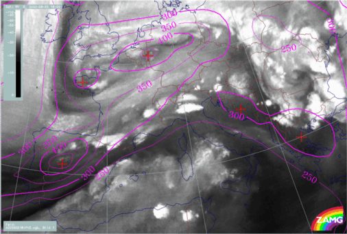
Upper Level Features
|
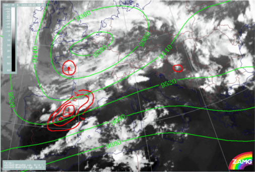
05 August 2002/18.00 UTC - Meteosat IR image; red: positive vorticity advection (PVA) 300 hPa, green: height contours 300 hPa
|
05 August 2002/018.00 UTC - Meteosat WV image; magenta: height of PV = 2 units
|
|
|
- PVA max at 500 and 300 hPa (not shown here) located over central N. Spain and Brittany indicate the approach of upper level troughs
- Distinct PV anomalies in the same areas indicate that stratospheric air has penetrated downward to approx. 450 hPa. As in well developed cases, there is a strong relationship between the PV anomalies and black areas/vortices in the WV image.


