14 - 15 JUNE 1998 - VSRF: 15 JUNE/06.00 - 18.00 UTC
by FMI
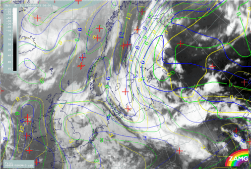
15 June 1998/06.00 UTC - Meteosat IR image; yellow: thermal front parameter 500/850 hPa 06.00 UTC, green: thermal front parameter 500/850 hPa 12.00 UTC,
blue: thermal front parameter 500/850 hPa 18.00 UTC
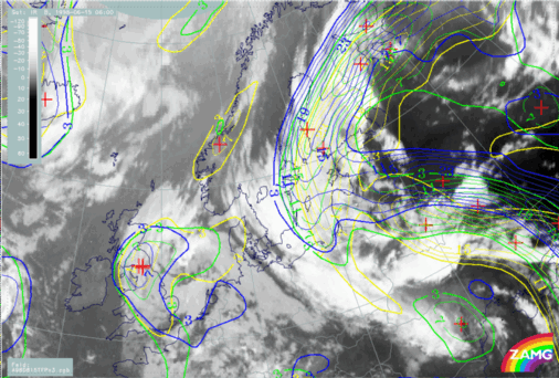
15 June 1998/06.00 UTC - Meteosat IR image; yellow: temperature advection - WA 06.00 UTC, green: temperature advection - WA 12.00 UTC, blue: temperature
advection - WA 18.00 UTC
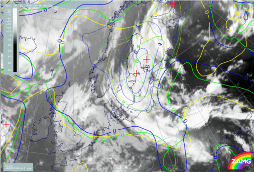
15 June 1998/06.00 UTC - Meteosat IR image; yellow: Showalter index 06.00 UTC, green: Showalter index 12.00 UTC, blue: Showalter index 18.00 UTC