14 - 15 JUNE 1998 - OVERVIEW OF SATELLITE FEATURES IN THE SYNOPTIC SCALE DURING THE OBSERVATION PERIOD
by FMI
- A Warm Front cloud band was located over Finland and Sweden, and it was accompanied by precipitation.
- A Cold Front cloud band was located over White Russia - Ukraine - Russia, and it was accompanied by rain and thunderstorms.
- A CCB Occlusion was located over Romania - Ukraine, and it was accompanied by precipitation.
|
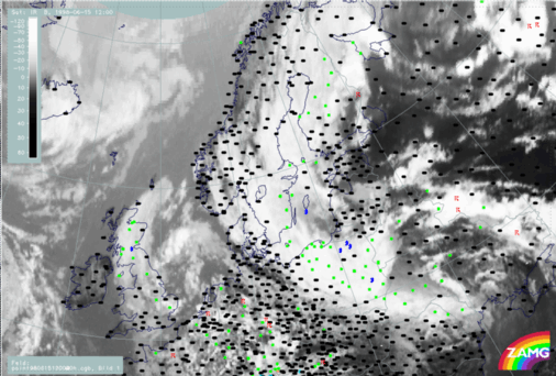
15 June 1998/12.00 UTC - Meteosat IR image; weather events (green: rain and showers, blue: drizzle, cyan: snow, red: thunderstorm with precipitation,
purple: freezing rain, orange: hail, black: no actual precipitation or thunderstorm with precipitation)
|
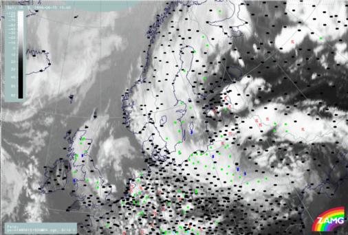
15 June 1998/15.00 UTC - Meteosat IR image; weather events (green: rain and showers, blue: drizzle, cyan: snow, red: thunderstorm with precipitation,
purple: freezing rain, orange: hail, black: no actual precipitation or thunderstorm with precipitation)
|
|
|
|
|
|
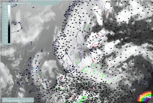
15 June 1998/18.00 UTC - Meteosat IR image; weather events (green: rain and showers, blue: drizzle, cyan: snow, red: thunderstorm with precipitation,
purple: freezing rain, orange: hail, black: no actual precipitation or thunderstorm with precipitation)
|


