14 - 15 JUNE 1998 - 15 JUNE/00.00 UTC: FRONTAL DIAGNOSIS
by FMI
Satellite Overview
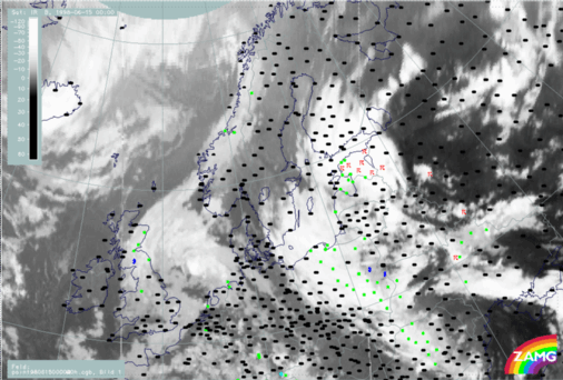
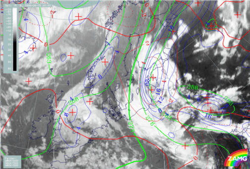
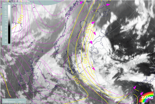
On 15 June a northward penetration of cloudiness takes place over Finland (Fig. H47). A double structure has developed at the Warm Front system; one part over Poland, Baltic Sea and Sweden, the other over the Baltic States and Finland. The old CCB Occlusion is still well developed. The connection from the Warm Front to the Cold Front is rather unorganized as seen in the cloud structures over the Baltic States and White Russia. The Cold Front becomes more organized over the area from the Ukraine to the Black Sea. There are many thunderstorms observed over Estonia. Notably, there is no precipitation in the downstream parts of the two cloud shields.
15 June 1998/00.00 UTC - Meteosat IR image; weather events (green: rain and showers, blue: drizzle, cyan: snow, red: thunderstorm with precipitation,
purple: freezing rain, orange: hail, black: no actual precipitation or thunderstorm with precipitation)
Parameters on isobaric surfaces
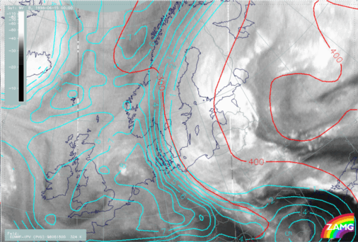
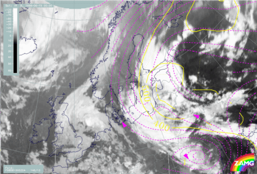
Compared to earlier water vapour images, there has been westward movement of the dark WV band in Fig. H48. A sharp boundary between tropospheric and stratospheric air is evident over Sweden. The eastward shift of zero line of shear vorticity at 300 hPa could again be a model error.
15 June 1998/00.00 UTC - Meteosat WV image; red: height of PV=2 units, black: shear vorticity 300 hPa
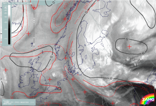
15 June 1998/00.00 UTC - Meteosat IR image; red: height contours 1000 hPa, green: height contours 500 hPa
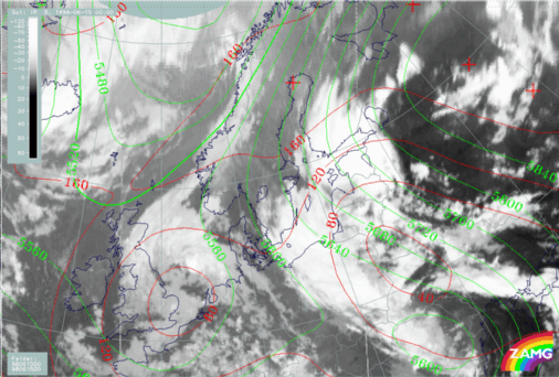
15 June 1998/00.00 UTC - Meteosat IR image; blue: thermal front parameter (TFP) 500/850 hPa, green: equivalent thickness 500/850 hPa, red: temperature
advection - CA 1000 hPa
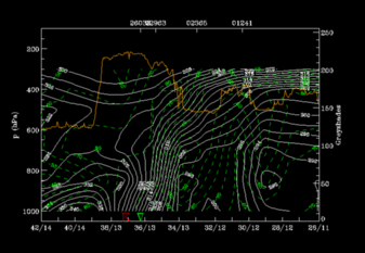
Vertical Cross Sections
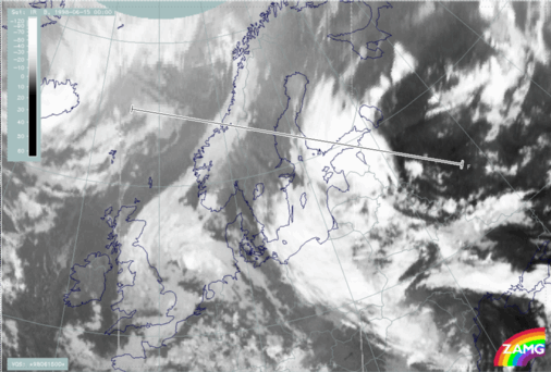
The vertical cross section line is perpendicular to the Warm Front over Finland and the Baroclinic Boundary over Norway. The orientation crosses the Warm Front from east to west (Fig. H51).
15 June 1998/00.00 UTC - Meteosat IR image; position of vertical cross section indicated
Isentropes and satellite pixel values
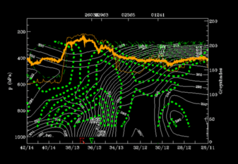
Very distinct Warm Front Band with very unstable air within and in the rear can be seen in Fig. H52. Broad IR and WV pixel value peaks are associated with both systems. The second IR peak is situated around station 01241 in front of the very steep zone of high gradient of isentropes. It corresponds to the Norwegian Baroclinic Boundary.
Temperature advection
There is distinct WA within the WF zone from the surface up to 300 hPa (Fig. H52). There is also WA in the unstable area in front of it up to 650 hPa with CA above - a typical distribution for instability. There is only very weak WA over Norway associated with the Baroclinic Boundary.
15 June 1998/00.00 UTC - Vertical cross section; white: isentropes (ThetaE), green thin: temperature advection - CA, green thick: temperature
advection - WA, orange thin: IR pixel values, orange thick: WV pixel values
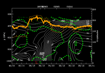
Convergence
In fig. H53 no distinct convergence associated with the WF can be seen, but there is some convergence in the region of the Baroclinic Boundary over Norway between approx. 900 - 600 hPa. The Warm Front Band characteristics are still clear to see.
15 June 1998/00.00 UTC - Vertical cross section; white: isentropes (ThetaE), green thin: divergence, green thick: convergence, orange thin: IR pixel
values, orange thick: WV pixel values
With help of parameters on isentropic surfaces: Air mass separation
Selection of characteristic isentropic surfaces (Fig. H54):- 312K: is within the Warm Front zone
- 324K: is partly directly on top of the Warm Front zone and partly further above, thus only relevant west of the unstable air mass.
15 June 1998/00.00 UTC - Vertical cross section; white: isentropes (ThetaE), green: relative humidity, orange thin: IR pixel values, orange thick: WV
pixel values
15 June 1998/00.00 UTC - Meteosat IR image; magenta: relative streams 312K, yellow: isobars
15 June 1998/00.00 UTC - Meteosat IR image; magenta: relative streams 324K, yellow: isobars
15 June 1998/00.00 UTC - Meteosat WV image; cyan: height of PV=2 units 324K, red: isobars 324K