14 - 15 JUNE 1998 - VSRF: 14 JUNE 06.00 - 18.00 UTC
by FMI
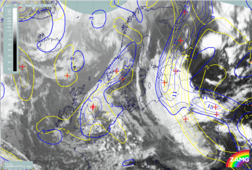
Focusing on the development of the baroclinic boundary from 06.00 to 18.00 UTC on 14 June, we see a general northward movement in TFP in Fig. H30. Over Finland the boundary moves slightly to the west. The TFP reaches eastern Finland by 18.00 UTC. The CF part moves very fast northeastward.
14 June 1998/06.00 UTC - Meteosat IR image; yellow: thermal front parameter 500/850 hPa 06.00 UTC, blue: thermal front parameter 500/850 hPa 18.00 UTC
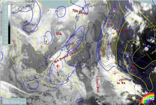
The temperature advection (H31) shows the same characteristics as TFP. There is northward movement of the WA maximum over Poland - White Russia at 06.00 UTC to the Baltic States at 18.00 UTC. At the same time the WA maximum is intensifying.
14 June 1998/06.00 UTC - Meteosat IR image; yellow: temperature advection - WA 06.00 UTC, blue: temperature advection - WA 18.00 UTC
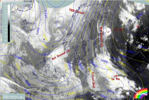
Looking at the 500 hPa height contours (H32), there is an eastward shift and intensification of the upper level trough over the Balkan peninsula and even the formation of an Upper Level Low. The continuous broad upper level flow from the south to Finland stays strong and even strengthens over the Ukraine.
14 June 1998/06.00 UTC - Meteosat IR image; yellow: height contours 500 hPa 06.00 UTC, blue: height contours 500 hPa 18.00 UTC
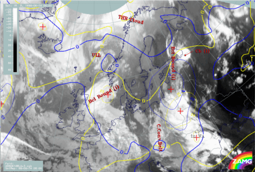
Tying these NWP observations to the 18 UTC satellite image we have a verification for the predicted development. The northward movement of the baroclinic boundary can also be seen in the cloudiness ahead and within the TFP areas over the Baltic Sea, the Baltic States and Southern Finland (H33). The cloudiness appearing within the warm sector in western Russia indicates unstable developments.
14 June 1998/18.00 UTC - Meteosat IR image; yellow: thermal front parameter 500/850 hPa 06.00 UTC, blue: thermal front parameter 500/850 hPa 18.00 UTC