15 - 16 MARCH 1998 - 09.00 - 12.00 UTC - KEY PARAMETERS ON ISOBARIC SURFACES
by ZAMG
|
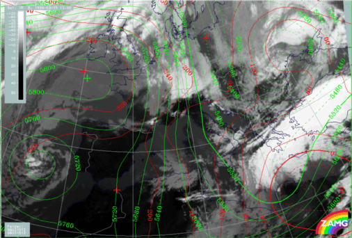
15 March 1998/12.00 UTC - Meteosat IR image; red: height contours 1000 hPa, green: height contours 500 hPa
|
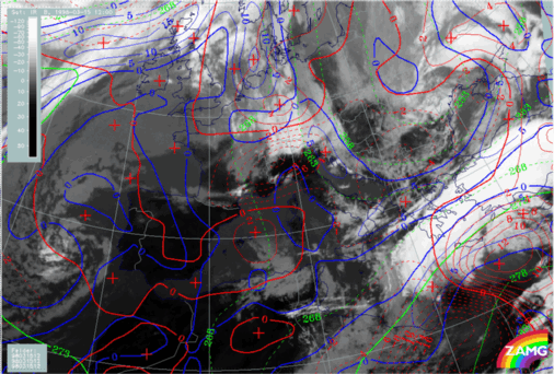
15 March 1998/12.00 UTC - Meteosat IR image; blue: thermal front parameter (TFP) 500/850 hPa, green: equivalent thickness 500/850 hPa, red:
temperature advection 1000 hPa
|
|
|
Apart from advection there are no dramatic changes in the height fields (left image) compared to the situation six hours before: surface low and upper level trough in the Mediterranean have moved eastward. Consequently a huge upper level trough extending from Romania across Greece to north Africa has developed.
The two frontal zones characterised by the TFP (right image) are very close together; the northern one is situated over north Greece, the southern one crosses Crete and has approached the Turkish south coast. During these movements the CA fields influence Greece, partly from the north connected with the Cold Front in Cold Advection, partly from the west behind the low system in the Mediterranean.
|
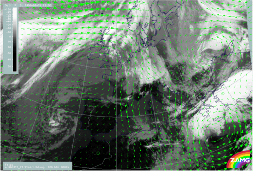
15 March 1998/12.00 UTC - Meteosat IR image; green: wind vectors 850 hPa
|
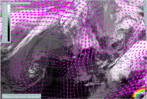
15 March 1998/12.00 UTC - Meteosat IR image; magenta: wind vectors 500 hPa
|
|
|


