15 - 16 MARCH 1998 - 09.00 - 12.00 UTC - OVERVIEW OF SATELLITE IMAGERY

by ZAMG


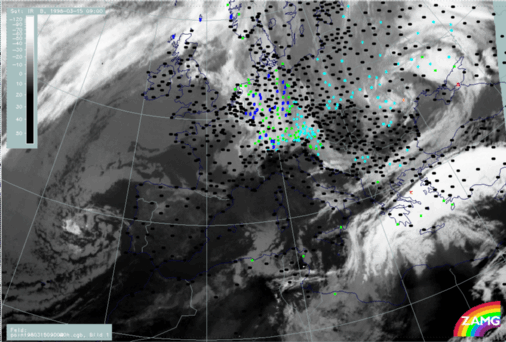
15 March 1998/09.00 UTC - Meteosat IR image; weather events (green: rain and showers, blue: drizzle, cyan: snow, red: thunderstorm with precipitation, purple: freezing rain, orange: hail, black: no actual precipitation or thunderstorm with precipitation)
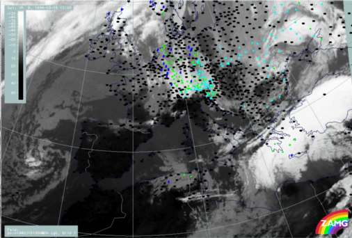
15 March 1998/12.00 UTC - Meteosat IR image; weather events (green: rain and showers, blue: drizzle, cyan: snow, red: thunderstorm with precipitation, purple: freezing rain, orange: hail, black: no actual precipitation or thunderstorm with precipitation)
In the IR images the same two frontal cloud bands can be identified as before. They are already much closer to each other at 09.00 UTC (left image) and finally have merged at 12.00 UTC (right image). The Warm Front cloud band is still very bright and accompanied by thunderstorms and rain in the Aegean Sea and on the Peloponnesus. The cloud band of the Cold Front in Cold Advection consists only of lower cloud tops and its weather intensity is decreasing. At 12.00 UTC it extends from the Black Sea across north Greece westward.
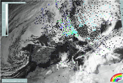
15 March 1998/09.00 UTC - Meteosat VIS image; weather events (green: rain and showers, blue: drizzle, cyan: snow, red: thunderstorm with precipitation, purple: freezing rain, orange: hail, black: no actual precipitation or thunderstorm with precipitation)
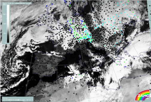
15 March 1998/12.00 UTC - Meteosat VIS image; weather events (green: rain and showers, blue: drizzle, cyan: snow, red: thunderstorm with precipitation, purple: freezing rain, orange: hail, black: no actual precipitation or thunderstorm with precipitation)
VIS images confirm that the warm front is accompanied by a thick cloud band with a rather smooth texture, while the northern Cold Front cloud band consists only of single cloud patches around 42N/31E, 41N/25E and 40N/21E and very small scale cold air cells with snow at their rear over Bulgaria.
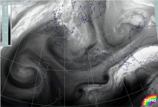
15 March 1998/09.00 UTC - Meteosat WV image
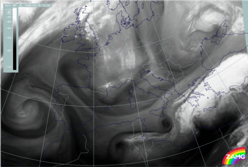
15 March 1998/12.00 UTC - Meteosat WV image
The WV images showing a grey warm front band add the information that there is a rather humid troposphere above the Cold Front in Cold Advection. But the most striking feature in the WV imagery is the black WV eye (compare Conceptual Models: Water Vapour Vortices ) in the Mediterranean south of Sicily, representing very dry sinking air. It is, however, not discussed in detail in this case study.

SUB-MENU OF 15 - 16 MARCH 1998
VERY SHORT RANGE FORECAST 06.00 - 18.00 UTC
09.00 - 12.00 UTC - KEY PARAMETERS ON ISOBARIC SURFACES