29 - 30 JANUARY 1998 - DIAGNOSIS OF FRONTAL PARAMETERS
by FMI
|
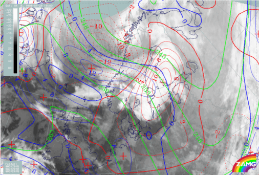
29 January 1998/18.00 UTC - Meteosat IR image; blue: thermal front parameter (TFP) 500/850 hPa, green: equivalent thickness 500/850 hPa, red:
temperature advection 1000 hPa
|
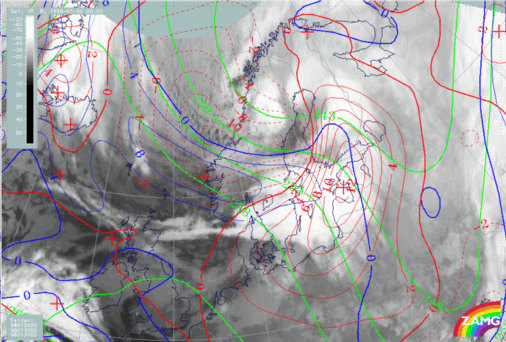
30 January 1998/00.00 UTC - Meteosat IR image; blue: thermal front parameter (TFP) 500/850 hPa, green: equivalent thickness 500/850 hPa, red:
temperature advection 1000 hPa
|
|
|
|
|
|
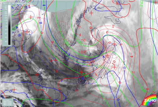
30 January 1998/06.00 UTC - Meteosat IR image; blue: thermal front parameter (TFP) 500/850 hPa, green: equivalent thickness 500/850 hPa, red:
temperature advection 1000 hPa
|
Towards 06.00 UTC on 30 January (left image bottom) the typical appearance of an Occlusion is very clear: TFP associated with thickness ridge and associated warm advection beneath mark the location of the Occlusion. A lot of EC cloudiness (with also the aforementioned Comma cloud) is seen in the area of the thickness trough.


