29 - 30 JANUARY 1998 - 12.00 UTC - FRONTAL AND WAVE DIAGNOSIS
by FMI
|
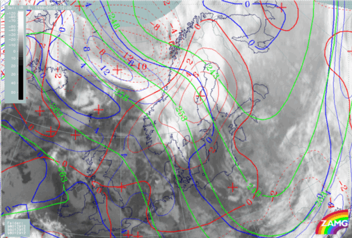
29 January 1998/12.00 UTC - Meteosat IR image; blue: thermal front parameter (TFP) 500/850 hPa, green: equivalent thickness 500/850 hPa, red: temperature
advection 1000 hPa
|
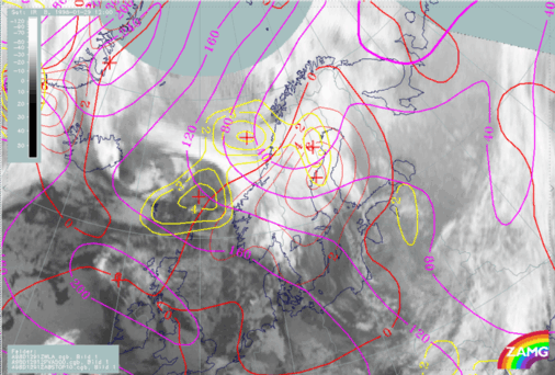
29 January 1998/12.00 UTC - Meteosat IR image; magenta: height contours 1000 hPa, green: positive vorticity advection (PVA) 500 hPa, red: temperature
advection - WA 1000 hPa
|
|
|
|
|
|
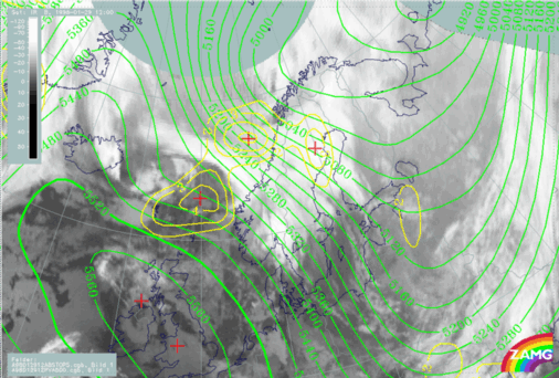
29 January 1998/12.00 UTC - Meteosat IR image; green: height contours 500 hPa, yellow: positive vorticity advection (PVA) 500 hPa
|
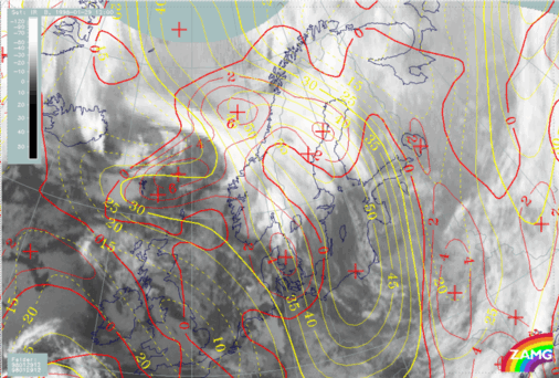
29 January 1998/12.00 UTC - Meteosat IR image; yellow: isotachs 300 hPa, red: positive vorticity advection (PVA) 300 hPa
|
The Wave parameters fit relatively well over north Sweden and coincide with the cloud structures. However, two PVA maxima can be found; the western one south-west of Lofoten is a result of curvature vorticity. Surface pressure contours are stretching southwards, the low pressure centre only slowly deepening and having a minimum pressure in north Sweden of about 1000 hPa.
The upper level trough and the western PVA maximum (67N/09E) are well correlated; the upper level trough coincides with cold air cloudiness. The PVA maximum is superimposed on the cloud band; the eastern PVA maximum over north Sweden is correlated with the developing Wave. Height contours do not show any notable trough for this PVA maximum, which possibly takes over the leading role in the Wave development.
The double structure of PVA can be seen at both 300 hPa and 500 hPa. The western maximum at 67N/09E is located in the entrance region of the jet. The maximum over Sweden and Finland doesn't have the usual relation to the jet streak; the reason for this is unclear.


