29 - 30 JANUARY 1998 - 12.00 UTC - SATELLITE OVERVIEW
by FMI
|
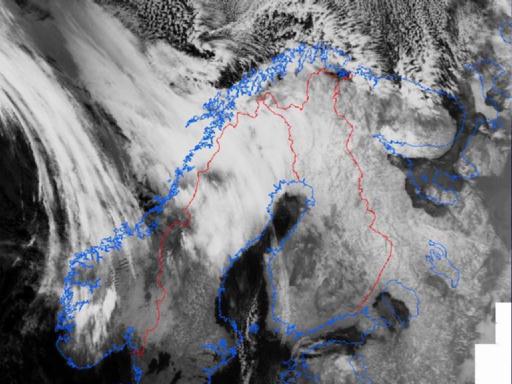
29 January 1998/08.24 UTC - NOAA CH5 image
|
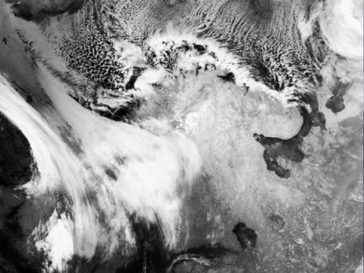
29 January 1998/11.36 UTC - NOAA CH4 image
|
|
|
|
|
|
|
|
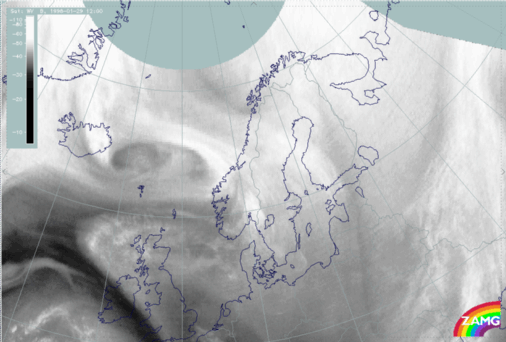
29 January 1998/12.00 UTC - Meteosat WV image
|
|
The evolution of the wave can be followed best with NOAA imagery (left and right images top). In the morning the wavy appearance is becoming clearer, and around noon the classical appearance of a Wave is evident. A structure which can be called a
cloud head can be noticed over Sweden and Finland, centred around 65N/23E. The Meteosat water vapour image reveals a distinct higher WV cloud edge extending from 68N/10E - 65N/25E and a lower WV cloud bulge penetrating from below over Sweden and Finland around 66N/22E. A dry Dark Stripe extends from 72N/05E into northern Norway.