29 - 30 JANUARY 1998 - 12.00 UTC - CROSS SECTIONS
by FMI
|
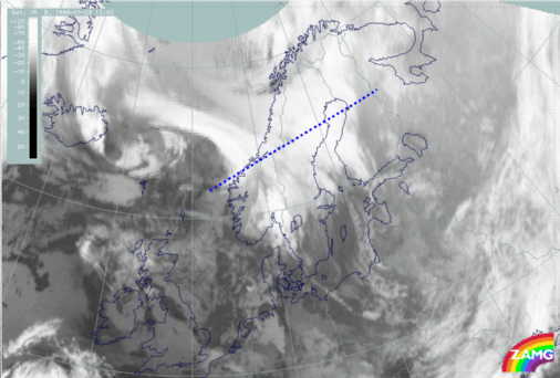
29 January 1998/12.00 UTC - Meteosat IR image; position of vertical cross section indicated
|
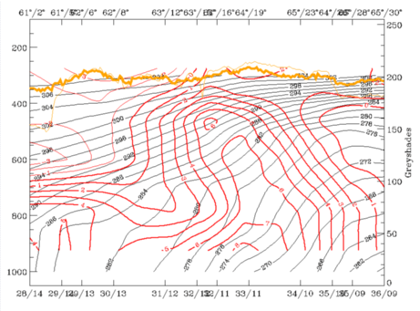
29 January 1998/12.00 UTC - Vertical cross section; black: isentropes (ThetaE), red thin: temperature advection - CA, red thick: temperature advection - WA,
orange thin: IR pixel values, orange thick: WV pixel values
|
|
|
|
The cross section is across the wave cloud band (left image) within the warm advection area of the Wave. The isentropes show a distinct warm advection maximum in the Wave area (right image). Warm advection extends throughout the troposphere. Two Warm Front - like zones with surface fronts can be seen; these frontal zones merge in middle altitudes in the centre of the cross section. The cold advection on top of warm advection in the left part of the cross section is associated with the south-western cloud band, and shows the unstable developments taking place near the coast of Norway. This process is due to the approach of an upper level low from east of Iceland.
|
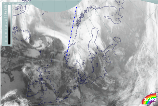
29 January 1998/12.00 UTC - Meteosat IR image; position of vertical cross section indicated
|
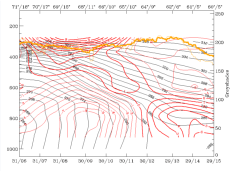
29 January 1998/12.00 UTC - Vertical cross section; black: isentropes (ThetaE), red thin: temperature advection - CA, red thick: temperature advection - WA,
orange thin: IR pixel values, orange thick: WV pixel values
|
|
|
|
Another cross section taken perpendicular to the Cold Front over the Norwegian Sea shows the temperature advection across the front. The cold air outbreak has spread as far as latitude 65N, and comparison with the respective cross section 12 hours earlier (compare
The synoptic situation over the Arctic Sea before the development; note reversed viewing angle) shows that the cold advection has grown significantly in depth, although the intensity in the lowest layers has somewhat decreased. This is a typical example of a transformation of a shallow Arctic Front into a one containing deeper baroclinity.