29 - 30 JANUARY 1998 - 06.00 UTC- FRONTAL, WAVE AND JET STREAK DIAGNOSIS
by FMI
|
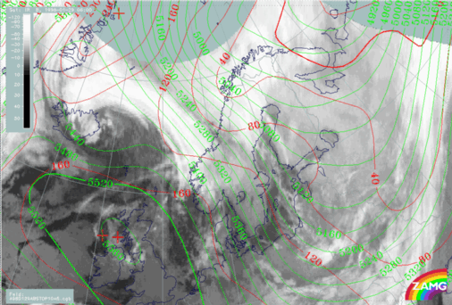
29 January 1998/06.00 UTC - Meteosat IR image; red: height contours 1000 hPa, green: height contours 500 hPa
|
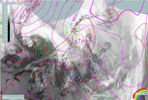
29 January 1998/06.00 UTC - Meteosat IR image; magenta: height contours 1000 hPa, green: positive vorticity advection (PVA) 500 hPa, red: temperature
advection - WA 1000 hPa
|
|
|
|
The locations of surface trough and upper trough indicate a configuration for a developing low with trough axis tilting backwards.
All numerical key parameters for wave development (positive vorticity advection at 500 hPa as well as warm advection) are fulfilled quite well around the Lofoten Islands.
|
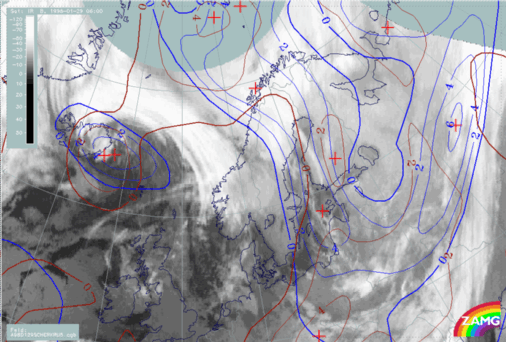
29 January 1998/06.00 UTC - Meteosat IR image; brown: curvature vorticity 500 hPa, blue: shear vorticity 500 hPa
|
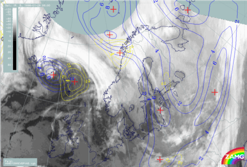
29 January 1998/06.00 UTC - Meteosat IR image; blue: relative vorticity 500 hPa, yellow: positive vorticity advection (PVA) 500 hPa
|
|
|
|
The PVA distribution at 500 hPa shows two distinct maxima. The first one is associated with the Icelandic upper level trough, while the other is connected to the upper trough and developing Wave over the Lofoten Islands. The inspection of vorticity components, shear and curvature shows that the resulting PVA is due to both vorticity and curvature vorticity north-west of the Lofoten Islands.
29 January 1998/06.00 UTC - Meteosat WV image; yellow: isotachs 300 hPa, black: shear vorticity 300 hPa
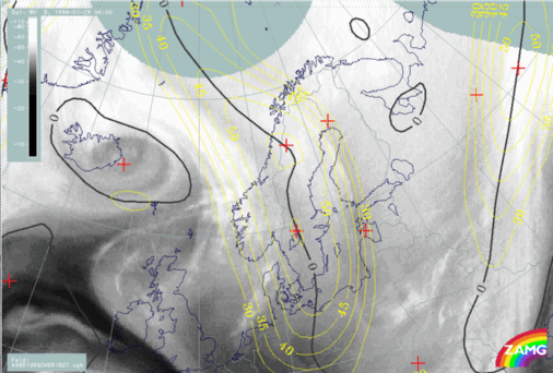
The model indicates one distinct very broad jet streak from the north-west across Scandinavia to north Germany and Poland. However, inspection of the WV image reveals
two Dark Stripes, indicating two separate jet axes. The western one extends from the north-west to west Sweden and is associated with the south-western cloud band. The second stripe extends from the north-west to west Finland. However, the model jet axis is in the middle between the two Black Stripes in the WV image. It seems quite clear that the ECMWF model does not resolve the two jet axes satisfactorily, even though the model vaguely indicates a double structure with two separate jet maxima over south and north Sweden. The actual soundings around the Bay of Bothnia at 06.00 UTC (not shown) actually indicated that the jet stream and, accordingly, the shear on the cyclonic side of the jet were more intensive than the model suggested.