29 - 30 JANUARY 1998 - 06.00 UTC- SATELLITE OVERVIEW
by FMI
|
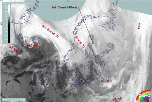
29 January 1998/06.00 UTC - Meteosat IR image; SatRep overlay: names of conceptual models
|
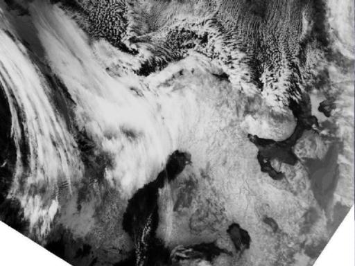
29 January 1998/06.24 UTC - NOAA CH4 image
|
|
|
|
An overview of the satellite features together with the SatRep conceptual models show two Baroclinic Boundaries. The south-western one extends from Iceland to south Norway, while the north-eastern one is located over north Norway and Sweden. A possible development area over 71N/18E is not mentioned here. The NOAA image of the same time reveals much more details, especially of the northern cloud system. The notable cloud streets generated by the outbreak of arctic air over the open sea are clearly seen. The north-eastern cloud system is beginning to have a Wave - like appearance; this essential development is impossible to see if only data from a geostationary satellite are used.