12 - 13 NOVEMBER 1997 - FRONT INTENSIFICATION BY JET STREAK CROSSING
by ZAMG
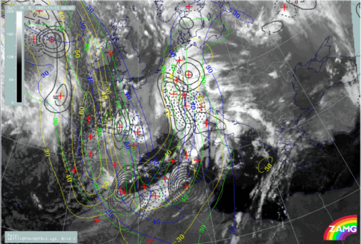
12 November 1997/06.00 UTC - Meteosat IR image; yellow: isotachs 300 hPa 06.00 UTC, green: height contours 1000 hPa 12.00 UTC, blue: height contours
1000 hPa 18.00 UTC, black solid: positive vorticity advection (PVA) 300 hPa 06.00 UTC, black dashed: positive vorticity advection (PVA) 300 hPa 12.00
UTC, black solid: positive vorticity advection (PVA) 300 hPa 18.00 UTC
|
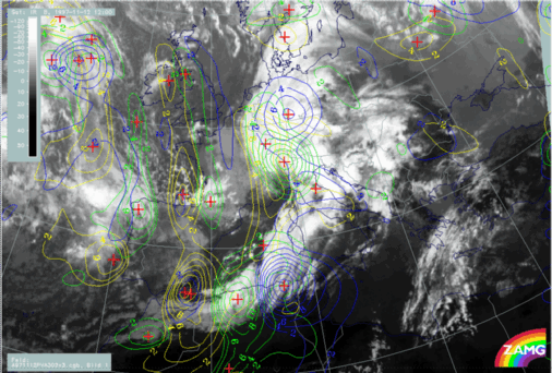
12 November 1997/12.00 UTC - Meteosat IR image; yellow: positive vorticity advection (PVA) 300 hPa 06.00 UTC, green: positive vorticity
advection (PVA) 300 hPa 12.00 UTC, blue: positive vorticity advection (PVA) 300 hPa 18.00 UTC
|
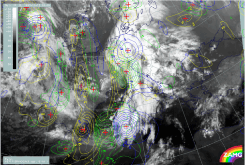
12 November 1997/18.00 UTC - Meteosat IR image; yellow: positive vorticity advection (PVA) 500 hPa 06.00 UTC, green: positive vorticity
advection (PVA) 500 hPa 12.00 UTC, blue: positive vorticity advection (PVA) 500 hPa 18.00 UTC
|
|
|


