12 - 13 NOVEMBER 1997 - OVERVIEW AND NEW ASPECTS
by ZAMG
12 November 1997/12.00 UTC - Meteosat IR image
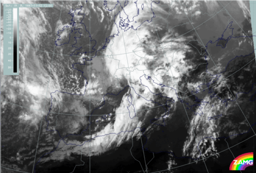
- The further development of the Wave leading to an advanced spiral structure over the west Alps
- The intensification of the Cold Front cloud band especially west of Sardinia and, as already discussed before, over the Algerian coast as a consequence of a jet streak crossing;
- A lot of structured cloudiness including high lee cloudiness in the thickness ridge in front of the Cold Front band over the Balkan Peninsula, similar to 06.00 UTC.
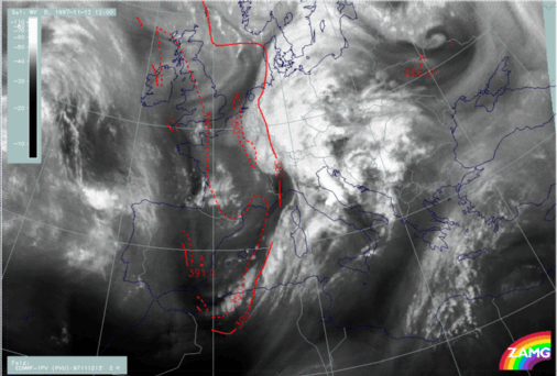
12 November 1997/12.00 UTC - Meteosat VIS image; red: height contours 1000 hPa
- There is a notable discrepancy between the main surface minimum over south Germany and the spiral configuration with its centre over north-west Italy; this is discussed and explained later;
- In contrast to the IR image, in which high lee cloudiness can be identified within the thickness ridge cloudiness over the Balkan Peninsula, the main characteristic in the VIS image is the lower lee cloudiness in the form of parallel cloud lines, as for instance over central Italy in the lee of the Apennines and the Croatian coast, and Bosnia and Yugoslavia in the lee of the Balkan mountains.
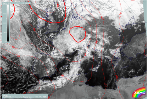
12 November 1997/12.00 UTC - Meteosat WV image; red: height of PV = 2 units