02 - 03 AUGUST 1997 - DEVELOPMENT OF CLOUD CONFIGURATIONS DURING VERY SHORT RANGE FORECAST FOR 03 AUGUST 06.00 UTC - 18.00 UTC

by ZAMG


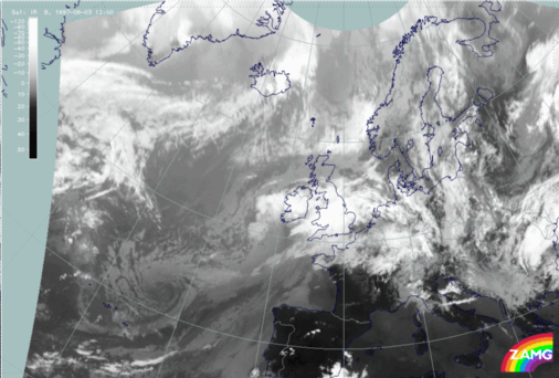
02 August 1997/12.00 UTC - Meteosat IR image
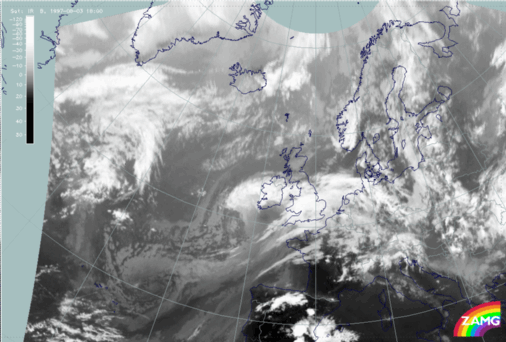
02 August 1997/18.00 UTC - Meteosat IR image
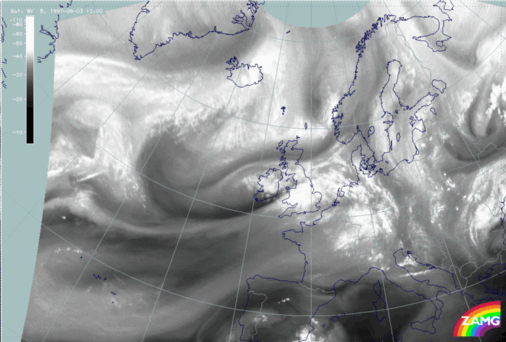
02 August 1997/12.00 UTC - Meteosat WV image
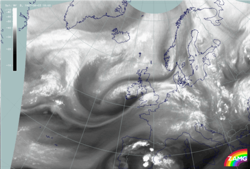
02 August 1997/18.00 UTC - Meteosat WV image
As can be seen from the IR (left and right image top) and WV images (left and right image bottom) a very intensive Rapid Cyclogenesis develops between 12.00 and 18.00 UTC. The most pronounced features are the intensive broadening of the WV Dark Stripe and the lowering of the cloud tops there; this happens in an area immediately to the south of Ireland. On the other hand there is a dramatic intensification of the cloudiness mostly in cellular convective form over and north-west of Ireland.

The latter fact will be emphasised with the help of relevant key parameters on isentropic surfaces (compare Diagnosis for 03 August 18.00 UTC with parameters on isentropic surfaces).


SUB-MENU OF 02 - 03 AUGUST 1997
INTRODUCTION FOR VERY SHORT RANGE FORECAST
DIAGNOSIS FOR 03 AUGUST 18.00 UTC WITH PARAMETERS ON ISENTROPIC SURFACES