02 - 03 AUGUST 1997 - INTRODUCTION FOR VERY SHORT RANGE FORECAST
by ZAMG
|
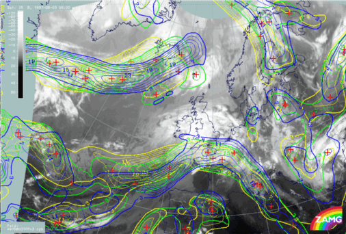
02 August 1997/06.00 UTC - Meteosat IR image; yellow: thermal front parameter (TFP) 500/850 hPa 06.00 UTC, green: thermal front
parameter (TFP) 500/850 hPa 12.00 UTC, blue: thermal front parameter (TFP) 500/850 hPa 18.00 UTC
|
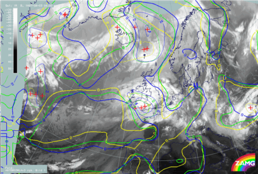
02 August 1997/06.00 UTC - Meteosat IR image; yellow: temperature advection - WA 1000 hPa 06.00 UTC, green: temperature advection - WA
1000 hPa 12.00 UTC, blue: temperature advection - WA 1000 hPa 18.00 UTC
|
|
|
|

|
|
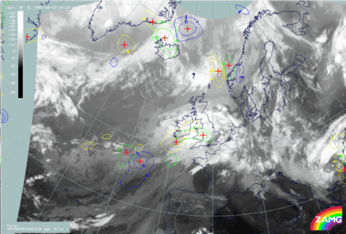
02 August 1997/06.00 UTC - Meteosat IR image; yellow: positive vorticity advection (PVA) 300 hPa 06.00 UTC, green: positive vorticity
advection (PVA) 300 hPa 12.00 UTC, blue: positive vorticity advection (PVA) 300 hPa 18.00 UTC
|
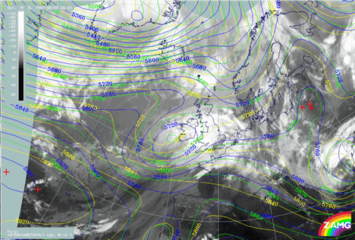
02 August 1997/06.00 UTC - Meteosat IR image; yellow: height contours 1000 hPa 06.00 UTC, green: height contours 1000 hPa 12.00 UTC, blue:
height contours 1000 hPa 18.00 UTC
|
03 August 1997/06.00 UTC - Meteosat IR image; yellow: height contours 500 hPa 06.00 UTC, green: height contours 500 hPa 12.00 UTC, blue: height
contours 500 hPa 18.00 UTC
Summarizing, from the diagnosis of the 06.00 UTC situation and the VSRF of all relevant key parameters, many clues can be found for the occurence of Rapid Cyclogenesis. This will be verified by the sequence of images.


