02 - 03 AUGUST 1997 - KEY PARAMETERS ON ISOBARIC SURFACES FOR 03 AUGUST 06.00 UTC
by ZAMG
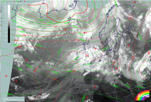
03 August 1997/06.00 UTC - Meteosat IR image; red: height contours 1000 hPa, green: height contours 500 hPa
|
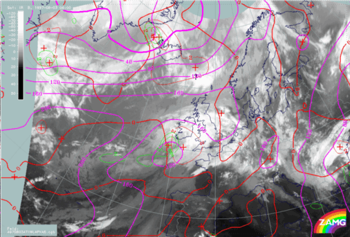
03 August 1997/06.00 UTC - Meteosat IR image; magenta: height contours 1000 hPa, green: positive vorticity advection (PVA) 500 hPa,
red: temparature advection - WA 1000 hPa
|
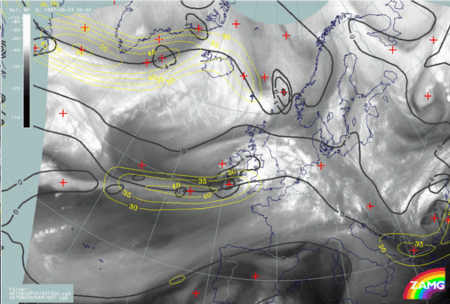
03 August 1997/00.00 UTC - Meteosat WV image; black: positive vorticity advection (PVA) 300 hPa, yellow: isotachs 300 hPa, black: shear
vorticity 300 hPa
|
|
|
- The surface low and the WA maximum are more distinct now;
- All parameters fit better together than before.
So there is a strong indication of Rapid Cyclogenesis developing in the next time period. To check this possibility, the parameters for the next 12 hours, i.e. for the VSRF, are inspected.


