02 - 03 AUGUST 1997 - DIAGNOSIS FOR 03 AUGUST 18.00 UTC WITH PARAMETERS ON ISENTROPIC SURFACES
by ZAMG
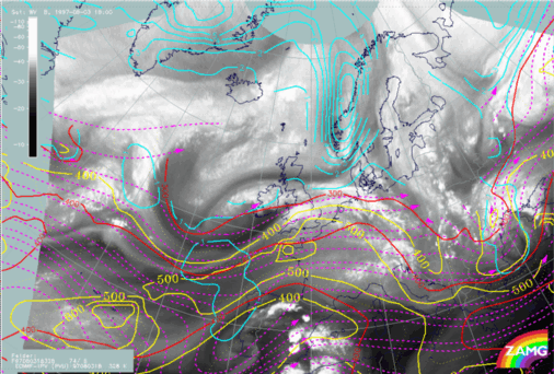
03 August 1997/18.00 UTC - Meteosat IR image; position of vertical cross section indicated
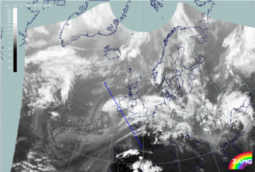
In this chapter the intensification of cloudiness, especially convective cloudiness over and north-west of Ireland at 18.00 UTC, is related to relative streams. The vertical cross section line crosses this area of cloudiness as well as the area of cloud dissolution south of Ireland.
03 August 1997/18.00 UTC - Vertical cross section; black: isentropes (ThetaE), orange thin: IR pixel values, orange thick: WV pixel values
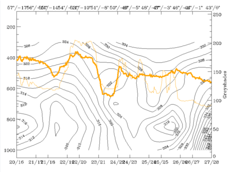
The vertical cross section shows a cold frontal zone inclined downward from approximately 400 hPa at 54N/11W down to the surface at approximately 50N/07W. The high pixel values are on top of this frontal zone while the minimum around 50N/05W corresponds to the dry WV Black Stripe.
Isentropic surfaces 320K, 324K and 328K have been selected, representing respectively one surface within the frontal zone and two surfaces above.
Relative streams on these surfaces show many of the typical features of Rapid Cyclogenesis development and indicate clearly the area most probable for cloud development.
|
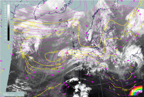
03 August 1997/18.00 UTC - Meteosat IR image; magenta: relative streams 320K - system velocity 74° 8 m/s, yellow: isobars
|
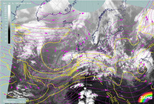
03 August 1997/18.00 UTC - Meteosat IR image; magenta: relative streams 324K - system velocity 74° 8 m/s, yellow: isobars
|
|
|
|
On the lowest isentropic surface of 320 K (left image) the typically rising and splitting stream can be identified exactly over Ireland. Rising is very pronounced there. On the 324K surface (right image), which is above the frontal surface, relative streams from the north-west represent the dry intrusion. This is also a typical distribution for rapid cyclogenesis situations; as it should be in the ideal case, this relative stream is sinking and thereby supporting the cloud dissolution area south of Ireland.
03 August 1997/18.00 UTC - Meteosat IR image; cyan: potential vorticity 328K, red: isobars for potential vorticity, magenta: relative
streams 320K - system velocity 74° 8 m/s, yellow: isobars for relative streams
On the still higher surface of 328K the same sinking relative stream from north-west can be noticed. As can be seen from the values of PV, dry but not stratospheric air is transported.