02 - 03 AUGUST 1997 - DEVELOPMENT OF CLOUD CONFIGURATIONS DURING VERY SHORT RANGE FORECAST
by ZAMG
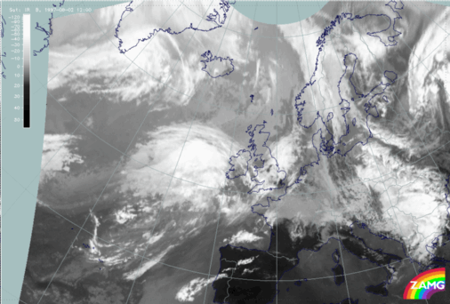
02 August 1997/12.00 UTC - Meteosat VIS image
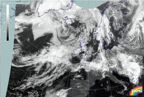
The image above is the visible image for 12.00 UTC. Apart from the eastward movement, no important change can be noticed in the cloud structures: there is still a pronounced Warm Front cloud shield and a distinct south-west - north-east oriented line separating the two cloud layers at different heights.
|
02 August 1997/12.00 UTC - Meteosat IR image
|
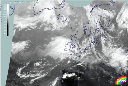
02 August 1997/18.00 UTC - Meteosat IR image
|
|
|
|
The images above are the relevant IR images, which support these results even more: the Warm Front cloud shield is well-pronounced, moves eastward and reaches Ireland at 18.00 UTC; there is no notable change in the two cloud layers at different heights.
Both the VIS and IR channels reveal a configuration which has some similarities with Rapid Cyclogenesis in an initial stage but does not show any development during this time. On the other hand also do not show the cloud features typical of an Upper Level Low development as it is recognized in the numerical model fields.
|
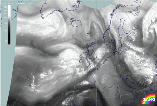
02 August 1997/12.00 UTC - Meteosat WV image
|
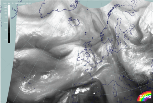
02 August 1997/18.00 UTC - Meteosat WV image
|
|
|
|
As the configurations for upper level lows are very distinct in the WV images, the 12.00 UTC image (left) and 18.00 UTC image (right) should give some hints; and indeed there is a broadening and increasing cyclonic curvature of the Black Stripe on the rear side of the intensive Warm Front Shield. But this Black Stripe and the cyclonic structure has no effect on the cloud structure in the VIS and IR images.
The typical cloud and WV features of an Upper Level Low are respectively two cloud and WV bands cyclonically curved against each other, leaving a dry area in the centre. In this case the superposition of two different CMs does not allow the development of those distinct features, but the WV band on the north-west side of the broadening Black Stripe, and the black area itself, can be regarded as typical Upper Level Low WV features.
02 August 1997/18.00 UTC - Meteosat IR image; yellow: height contours 500 hPa 06.00 UTC, green: height contours 500 hPa 12.00 UTC, blue:
height contours 500 hPa 18.00 UTC
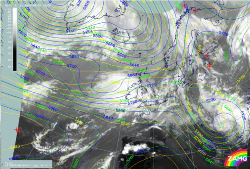
The image shows a perfect correlation between the upper level trough, which is nearly cut off, and the low cloud tops with a dry WV slot above (compare right image above) as well as a WV band on the rear side.