02 - 03 AUGUST 1997 - VERY SHORT RANGE FORECAST FROM 02 AUGUST 06.00 UTC - 18.00 UTC
by ZAMG
|
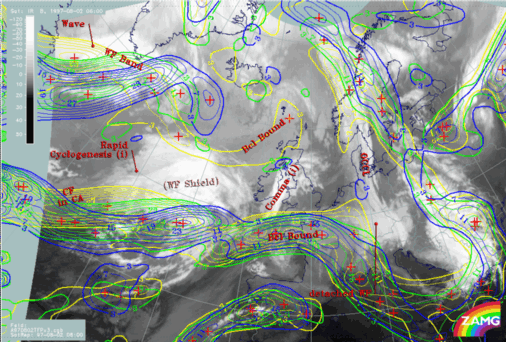
02 August 1997/06.00 UTC - Meteosat IR image; yellow: thermal front parameter (TFP) 500/850 hPa 06.00 UTC, green: thermal front
parameter (TFP) 500/850 hPa 12.00 UTC, blue: thermal front parameter (TFP) 500/850 hPa 18.00 UTC; SatRep overlay: names of conceptual
models
|
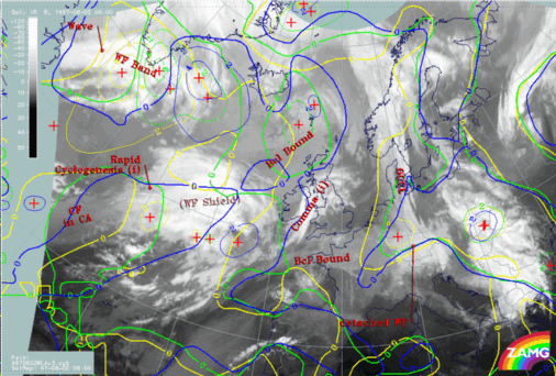
02 August 1997/06.00 UTC - Meteosat IR image; yellow: temperature advection - WA 1000 hPa 06.00 UTC, green: temperature advection - WA
1000 hPa 12.00 UTC, blue: temperature advection - WA 1000 hPa 18.00 UTC; SatRep overlay: names of conceptual models
|
|
|
|
|
|
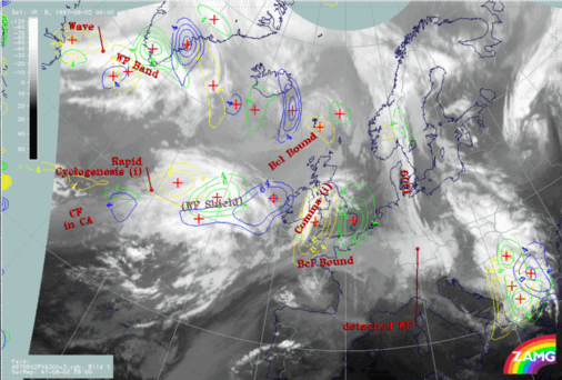
02 August 1997/06.00 UTC - Meteosat IR image; yellow: positive vorticity advection (PVA) 300 hPa 06.00 UTC, green: positive vorticity
advection (PVA) 300 hPa 12.00 UTC, blue: positive vorticity advection (PVA) 300 hPa 18.00 UTC; SatRep overlay: names of conceptual
models
|
|
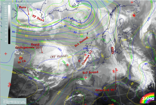
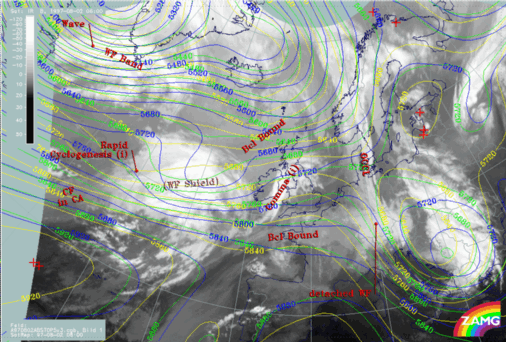
02 August 1997/06.00 UTC - Meteosat IR image; yellow: height contours 1000 hPa 06.00 UTC, green: height contours 1000 hPa 12.00 UTC,
blue: height contours 1000 hPa 18.00 UTC; SatRep overlay: names of conceptual models
|
02 August 1997/06.00 UTC - Meteosat IR image; yellow: height contours 500 hPa 06.00 UTC, green: height contours 500 hPa 12.00 UTC, blue:
height contours 500 hPa 18.00 UTC; SatRep overlay: names of conceptual models
|
|
|


