29 JULY 1997 - DIAGNOSIS FOR 18.00 UTC WITH HELP OF VERTICAL CROSS SECTIONS
by ZAMG
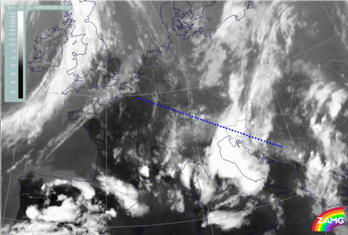
29 July 1997/18.00 UTC - Meteosat IR image; position of vertical cross section indicated
|
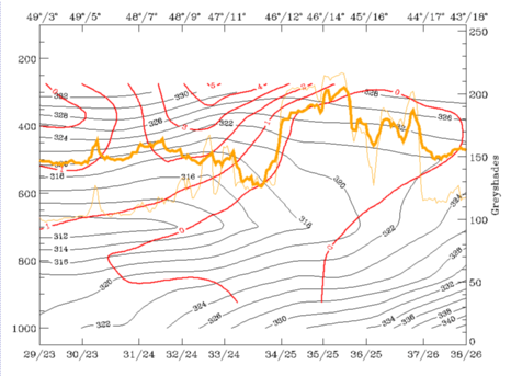
29 July 1997/18.00 UTC - Vertical cross section; black: isentropes (ThetaE), red thin: temperature advection - CA, red thick: temperature
advection - WA, orange thin: IR pixel values, orange thick: WV pixel values
|
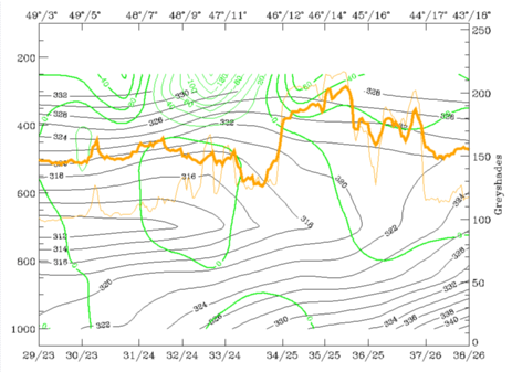
29 July 1997/18.00 UTC - Vertical cross section; black: isentropes (ThetaE), green thick: vorticity advection - PVA, green thin: vorticity
advection - NVA, orange thin: IR pixel values, orange thick: WV pixel values
|
|
|
|
|
|
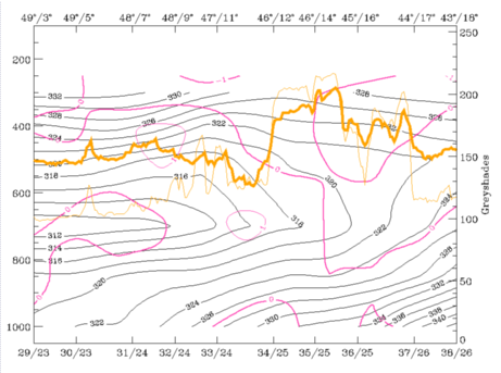
29 July 1997/18.00 UTC - Vertical cross section; black: isentropes (ThetaE), magenta thin: divergence, magenta thick: convergence, orange thin:
IR pixel values, orange thick: WV pixel values
|
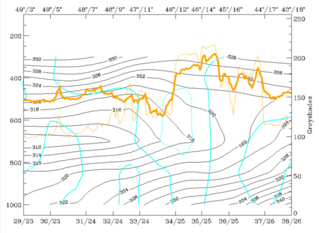
29 July 1997/18.00 UTC - Vertical cross section; cyan thick: vertical motion (omega) - upward motion, cyan thin: vertical motion (omega) -
downward motion, magenta thin: divergence, magenta thick: convergence, orange thin: IR pixel values, orange thick: WV pixel values
pixel values
|
The vertical distribution of convergence (bottom left image) and vertical motion (bottom right image), which were very important qualities in the discussion till now, confirm (as does temperature advection) that a change in the state of the troposphere is taking place, although there are still many thunderstorms. Convergence has a more diffuse appearance in the cloud area now and a transition to sinking motion has taken place.
In the following chapter dealing with the thunderstorm developments the breakdown of the convective situation from this time on can be observed.


