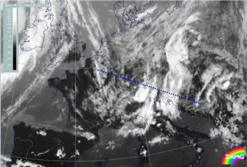
29 JULY 1997 - DIAGNOSIS FOR 12.00 UTC WITH HELP OF VERTICAL CROSS SECTIONS
by ZAMG
|
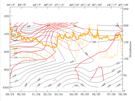
29 July 1997/12.00 UTC - Vertical cross section; black: isentropes (ThetaE), red thin: temperature advection - CA, red thick: temperature
advection - WA, orange thin: IR pixel values, orange thick: WV pixel values
|
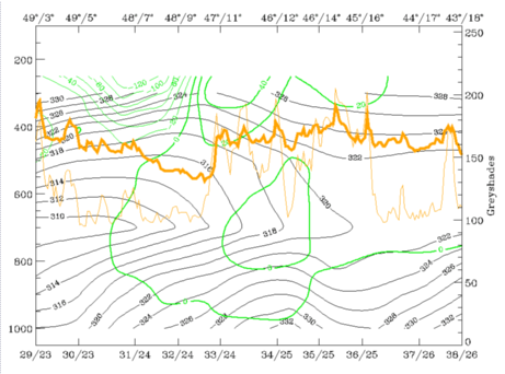
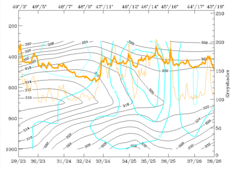
29 July 1997/12.00 UTC - Vertical cross section; black: isentropes (ThetaE), green thick: vorticity advection - PVA, green thin: vorticity
advection - NVA, orange thin: IR pixel values, orange thick: WV pixel values
|
|
|
|
|
|
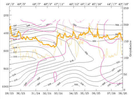
29 July 1997/12.00 UTC - Vertical cross section; black: isentropes (ThetaE), magenta thin: divergence, magenta thick: convergence, orange thin:
IR pixel values, orange thick: WV pixel values
|
29 July 1997/12.00 UTC - Vertical cross section; cyan thick: vertical motion (omega) - upward motion, cyan thin: vertical motion (omega) -
downward motion, magenta thin: divergence, magenta thick: convergence, orange thin: IR pixel values, orange thick: WV pixel values
pixel values
|
Several features are similar to or even more pronounced than at 06.00 UTC: isentropes do not show any notable frontal zone; the only exception might be a very weak upper level Cold Front extending from the western to the eastern system between 300 and 400 hPa. There is some indication for a Cold Front from the cold advection connected with the western system which has now already reached the western parts of the eastern system. This has to be evaluated together with the WA below leading to even more pronounced lability in this area at 12.00 UTC. This is supported by several thunderstorm reports there and also (as described later in the chapter on thunderstorm development) by the appreciable development of thunderstorms from this point of time on. The top right image indicates the approach of the western system, also indicated by the PVA which has its maximum at 300 hPa, and is now much closer to the eastern system than before.
The bottom left image shows still a thick layer with non-frontal convergence for both cloud systems, which is also a good indication for an unstable situation.
All these parameters contribute to vertical motion which can be seen in the bottom right image as a very intensive and distinct feature showing upward motion for both systems, but with a maximum in the area of their mergence.


