29 JULY 1997 - THE WESTERN CLOUD SYSTEM

by ZAMG


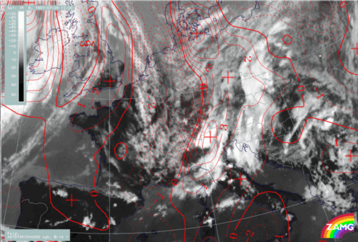
29 July 1997/12.00 UTC - Meteosat IR image; red: vorticity advection 300 hPa
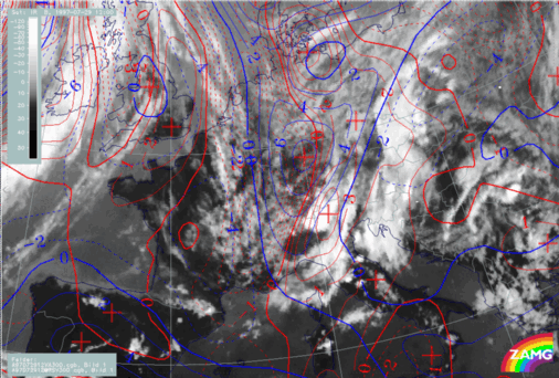
29 July 1997/12.00 UTC -Meteosat IR image; red: vorticity advection 300 hPa, blue: shear vorticity 300 hPa
As can be seen in the left image a distinct PVA maximum at 300 hPa coincides very well with the area of the western cloud system while there is only weak PVA for the eastern system. This PVA maximum is still connected with a maximum of shear vorticity (right image) representing a jet streak. The axis of this streak can also be diagnosed with help of the cloud fibres over the North Sea which are parallel and in good agreement with the zeroline of shear vorticity.

SUB-MENU OF 29 JULY 1997
SATELLITE FEATURES AND FRONTAL DIAGNOSIS FOR 12.00 UTC
THE EASTERN CLOUD SYSTEM