19 FEBRUARY 1997 - KEY PARAMETERS ON ISOBARIC SURFACES FOR RAPID CYCLOGENESIS 06.00 UTC
by ZAMG
|
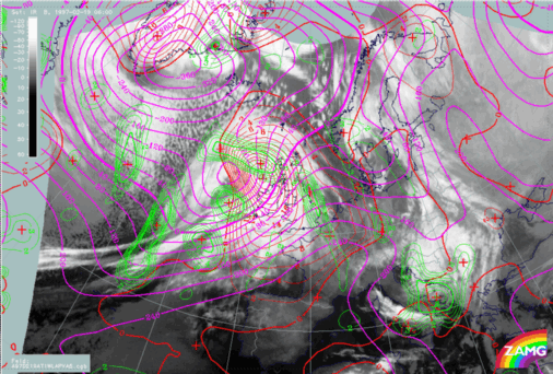
19 February 1997/06.00 UTC - Meteosat IR image; magenta: height contours 1000 hPa, green: positive vorticity advection (PVA) 500 hPa, red:
temparature advection - WA 1000 hPa
|
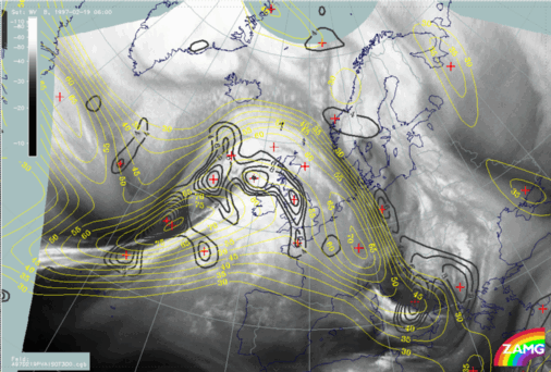
19 February 1997/06.00 UTC - Meteosat IR image; black: positive vorticity advection (PVA) 300 hPa, yellow: isotachs 300 hPa
|
|
|
The jet streak diagnosis in the right image is much easier now using the knowledge gained before. The dominant jet streak is at the rear side of the Cold Front with a south-west - north-east orientation, and the PVA maximum in its left exit region corresponds to the intensified cloud patches. However there is a second jet streak north of Scotland close to a substructure in the cloud shield there. It is common experience that such secondary jet streaks may develop in connection with a Rapid Cyclogenesis.
Hints for difficult PVA field interpretation
|
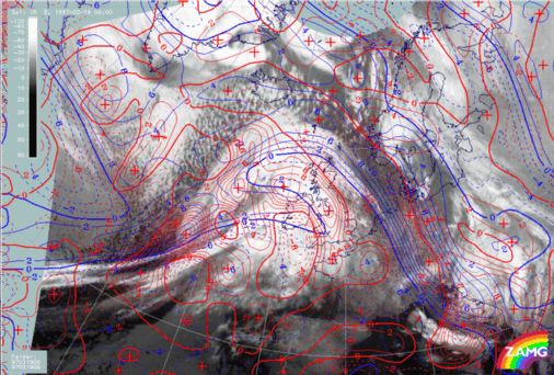
19 February 1997/06.00 UTC - Meteosat IR image; red: vorticity advection 300 hPa, blue: shear vorticity 300 hPa
|
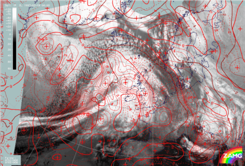
19 February 1997/06.00 UTC - Meteosat IR image; red: vorticity advection 300 hPa, brown: curvature vorticity 300 hPa
|
|
|
Summarizing, this case study showed that it was possible to detect and separate two conceptual models - a Rapid Cyclogenesis development and a comma-like cold air feature - by means of a synopsis of all key parameters relevant for the conceptual models mentioned.
One set of key parameters which has not yet been mentioned are relative streams on isentropic surfaces (compare Relative streams and conveyor belts for Rapid Cyclogenesis 06.00 UTC ).


