19 FEBRUARY 1997 - OVERVIEW OF SATELLITE IMAGERY FOR 06.00 UTC
by ZAMG
|
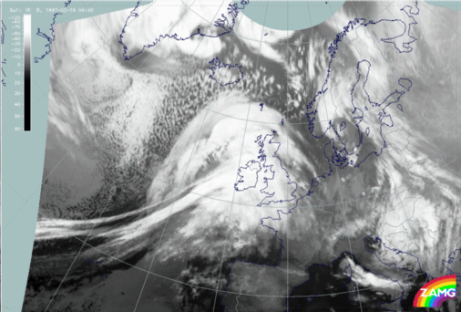
19 February 1997/06.00 UTC - Meteosat IR image
|
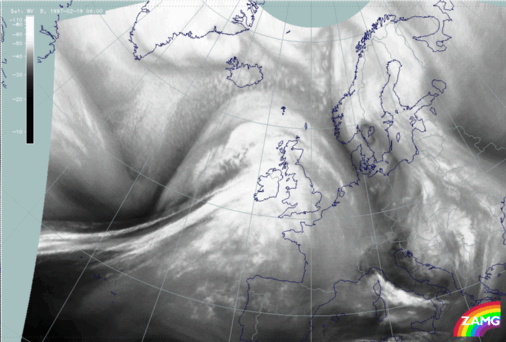
19 February 1997/06.00 UTC - Meteosat WV image
|
|
|
This black stripe separates the frontal cloud features from the cloud head to the north very distinctly. In contrast to the frontal features which have maintained their appearance during the last six hours, the cloud head has undergone many more changes. This will be discussed later in a separate chapter about Rapid Cyclogenesis and upper level features (compare Diagnosis of Rapid Cyclogenesis and Upper Level Trough Feature - 19 February 1997/00.00 UTC and Diagnosis of Rapid Cyclogenesis and Upper Level Trough Feature - 19 February 1997/06.00 UTC).


