19 FEBRUARY 1997 - OVERVIEW OF SATELLITE IMAGERY FOR 00.00 UTC
by ZAMG
|
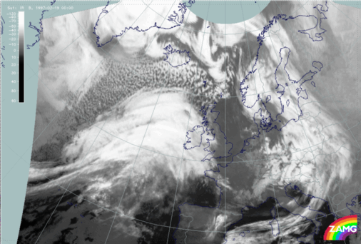
19 February 1997/00.00 UTC - Meteosat IR image
|
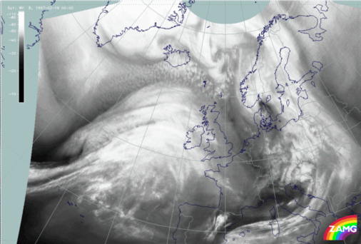
19 February 1997/00.00 UTC - Meteosat WV image
|
|
|
Besides the frontal cloud features an impressive cloud head can be recognized to the north, north-west of the line 44N/30W - 55N/15W. This cloud head suggests a Rapid Cyclogenesis but contains two substructures which deviate from the classical appearance of such a conceptual model. This will be discussed in detail in a separate chapter below (compare Diagnosis of Rapid Cyclogenesis and Upper Level Trough Feature - 19 February 1997/00.00 UTC).
The front diagnosis will be done by a combination of satellite images and relevant parameters on isobaric surfaces (compare Key parameters on isobaric surfaces for 00.00 UTC ) as well as by a combination of satellite signals with other synoptic data in the form of vertical cross sections (compare Use of vertical cross sections for 00.00 UTC ).

