12 MARCH 1996 - COLD FRONT AND BAROCLINIC BOUNDARY TO UPPER LEVEL LOW
by ZAMG
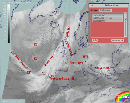
12 March 1996/06.00 UTC - Meteosat IR image; SatRep overlay: names of conceptual models, SatRep menu: key parameters for Cold Front forecast
The very short range forecast VSRF (06.00 - 18.00 UTC, 12 hours)
For the very short range forecast, six-hourly forecasts from ECMWF are used. Those parameters which are key parameters of a conceptual model are prepared as overlays on the satellite image in three different colours representing the three points of time 06.00, 12.00 and 18.00 UTC:- yellow: 06.00 UTC
- green: 12.00 UTC
- blue: 18.00 UTC
Nowcasting (0-2 hours)
For this forecast time, atmospheric motion vectors (AMVs) are used which extrapolate the cloud systems for the next two hours. These nowcasts are renewed half-hourly or hourly and are not discussed here.
12 March 1996/06.00 UTC - Meteosat IR image; yellow: thermal front parameter (TFP) 500/850 hPa 06.00 UTC, green: thermal front parameter (TFP) 500/850 hPa
12.00 UTC, blue: thermal front parameter (TFP) 500/850 hPa 18.00 UTC
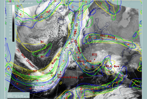
North of the Wave the front is nearly stationary, especially above the British Isles. Further north of Scotland the formation of an Instant Occlusion process, which is not discussed here, leads to a north-westerly movement again.
The Baroclinic Boundary reaching from the British Isles into the Mediterranean and forming the southern boundary of the Upper Level Low is stationary during the next 12 hours, which is expected considering the stationary state of the Upper Level Low. Only in the south-eastern part is a small shift recognizable.
|
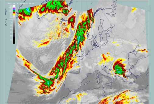
12 March 1996/06.00 UTC - Meteosat IR enhanced image
|
12 March 1996/12.00 UTC - Meteosat IR enhanced image
|
|
|
|
|
|
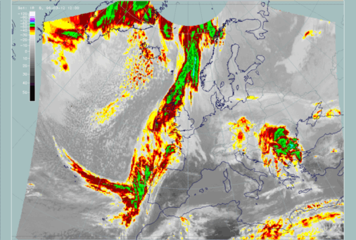
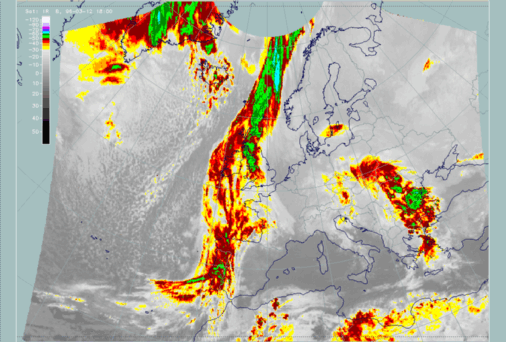
12 March 1996/18.00 UTC - Meteosat IR enhanced image
|


