02 - 03 JUNE 2000 - TEMPERATURE ADVECTION
by ZAMG
Temperature Advection
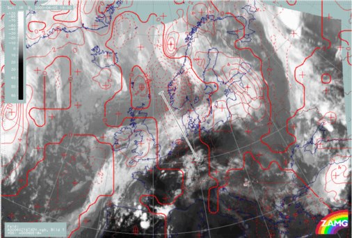
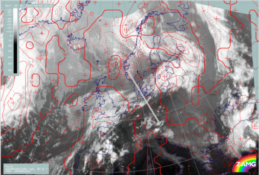
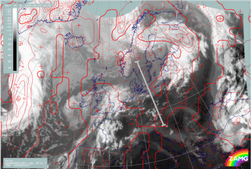
At 02/18.00 UTC there is marked CA over the frontal cloud band. The zero line of temperature advection (TA) appears almost at right angles to the front line.In the right image below, six hours later, the effect of this CA can already be seen as the dissipation zone of the frontal cloud band and there is very good agreement between the CA zone and the cloud gap. By 06.00 UTC the CA is weakening. Upstream, the maximum of WA is associated with the newly developed Warm Front over Great Britain and the North Sea. Downstream of the dissipation zone, a Cold Front in Warm Advection has developed.
|
02 June 2000/18.00 UTC - Meteosat IR image; red dashed: temperature advection - CA 700 hPa, red solid: temperature advection - WA 700 hPa, position of
vertical cross section indicated
|
03 June 2000/00.00 UTC - Meteosat IR image; red dashed: temperature advection - CA 700 hPa, red solid: temperature advection - WA 700 hPa, position of
vertical cross section indicated
|
|
|
|
|
|
03 June 2000/06.00 UTC - Meteosat IR image; red dashed: temperature advection - CA 700 hPa, red solid: temperature advection - WA 700 hPa, position of
vertical cross section indicated
|
|
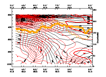
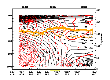
02 June 2000/18.00 UTC - Vertical cross section; black: isentropes (ThetaE), red thin: temperature advection - CA, red thick: temperature advection -
WA, orange thin: IR pixel values, orange thick: WV pixel values
|
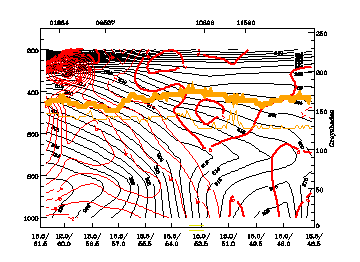
03 June 2000/00.00 UTC - Vertical cross section; black: isentropes (ThetaE), red thin: temperature advection - CA, red thick: temperature advection -
WA, orange thin: IR pixel values, orange thick: WV pixel values
|
|
|
|
|
|
03 June 2000/06.00 UTC - Vertical cross section; black: isentropes (ThetaE), red thin: temperature advection - CA, red thick: temperature advection -
WA, orange thin: IR pixel values, orange thick: WV pixel values
|


