02 - 03 JUNE 2000 - ABSOLUTE TOPOGRAPHY AT 500 HPA AND 1000 HPA
by ZAMG
Height contours at 500 hPa and 1000 hPa
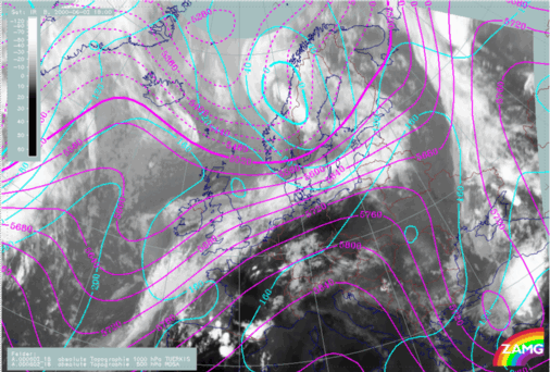
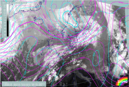
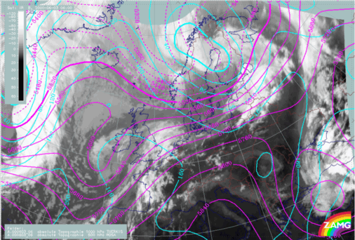
An extended upper level trough and a narrow low level depression with its associated frontal system generally persist at all stages of the Front Decay of the 02/03 June 2000. The acute angle between isolines of surface low and Upper Level Low indicates cold advection to the rear of and over the cloud band at 02/18.00 UTC. The angle between the isolines of the 1000 hPa and the 500 hPa height contours is decreasing a little during the life cycle, indicating a decrease in the intensity of CA during the following stages. The upper level isolines indicate a strong jet streak parallel to the frontal cloud band.|
02 June 2000/18.00 UTC - Meteosat IR image; magenta: height contours 1000 hPa, cyan: height contours 500 hPa
|
03 June 2000/00.00 UTC - Meteosat IR image; magenta: height contours 1000 hPa, cyan: height contours 500 hPa
|
|
|
|
|
|
03 June 2000/06.00 UTC - Meteosat IR image; magenta: height contours 1000 hPa, cyan: height contours 500 hPa
|


