02 - 03 JUNE 2000 - THERMAL FRONT PARAMETER AND EQUIVALENT THICKNESS
by ZAMG
Thermal Front Parameter and Equivalent Thickness
|
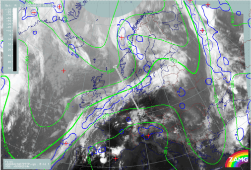
02 June 2000/18.00 UTC - Meteosat IR image; blue: thermal front parameter (TFP) 500/850 hPa, green: equivalent thickness 500/850 hPa, position of vertical
cross section indicated
|
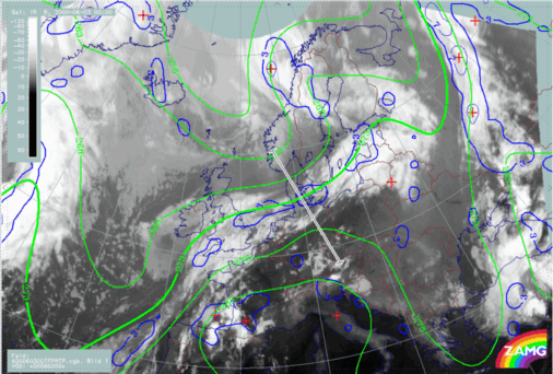
03 June 2000/00.00 UTC - Meteosat IR image; blue: thermal front parameter (TFP) 500/850 hPa, green: equivalent thickness 500/850 hPa, position of vertical
cross section indicated
|
|
|
|
|
|
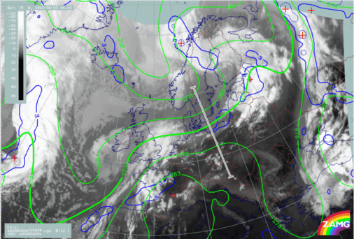
03 June 2000/06.00 UTC - Meteosat IR image; blue: thermal front parameter (TFP) 500/850 hPa, green: equivalent thickness 500/850 hPa, position of vertical
cross section indicated
|
Although the lines of equivalent thickness show an even tighter gradient at 00.00 UTC, the thermal front parameter (TFP) is not as well developed. At 06.00 UTC, the isolines of equivalent thickness still have a tight gradient but there is, no longer, any significant TFP over the dissipation zone.


