29 MAY 2000 - RELATIVE STREAMS
by FMI
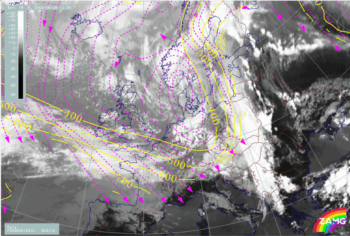
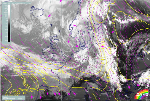
The relative streams at both levels show hardly any cold air moving from behind the Cold Front into the region of the Convergence Line at upper levels. The limiting streamline in the upper levels is well within the cold front cloud band. Thus, the cold air stream from behind the front cannot contribute significantly to the development of convection. The pre-frontal convergence, at least in this case, is not triggered by over-running cold air advection (as in the case of Kata Cold Fronts), but rather by processes in the warm air ahead of the Cold Front.
|
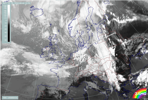
29 May 2000/12.30 UTC - Meteosat IR image; position of vertical cross section indicated
|
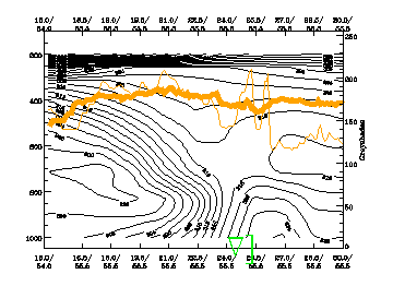
29 May 2000/12.00 UTC - Vertical cross section; black: isentropes (ThetaE), red thin: temperature advection - CA, orange thin: IR pixel
values, orange thick: WV pixel values
|
|
|
|
|
|
29 May 2000/12.30 UTC - Meteosat IR image; magenta: relative streams 310K - system velocity: 203° 12 m/s, yellow: isobars
|
29 May 2000/12.30 UTC - Meteosat IR image; magenta: relative streams 318K - system velocity: 203° 13 m/s, yellow: isobars
|


