29 MAY 2000 - LAM MODEL OUTPUT
by FMI
ECMWF model data used so far has performed fairly well in showing the general features of this pre-frontal Convergence Line. After all, a global model should not be expected to show the fine structure of the Convergence Line. For this, a high-resolution limited area model (LAM) may bring additional and more detailed information about the Convergence Line.
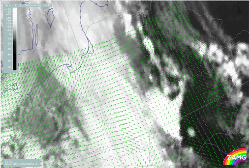
The wind field at 925 hPa, from the Aladin analysis used here, provides a good description of some of the important processes associated with the development of the Convergence Line. The convergence near the surface ahead of the frontal cloudiness is clearly seen as the wind direction changes by about 90 degrees almost exactly at the Convergence Line. Furthermore the Warm Conveyor Belt bringing in warm air from the south-southeast is revealed by the wind vectors ahead of the Cold Front.
29 May 2000/12.30 UTC - Meteosat IR image; green: wind vectors 925 hPa
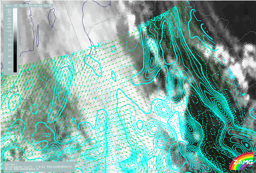
Additionally the divergence and omega fields of the Aladin analysis capture the general features of the Convergence Line quite well. In fact, the Aladin analyses of divergence and omega fields even show a clear cellular structure. However, the convection cells are displaced by the analysis, as it fails to show correctly the small scale features of, for instance, the updraft in the developing Convergence Line.
|
29 May 2000/12.30 UTC - Meteosat IR image; cyan solid: convergence 925 hPa, cyan dashed: divergence 925 hPa, green: wind vectors 925 hPa
|
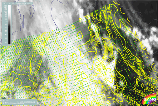
29 May 2000/12.00 UTC - Meteosat IR image; yellow solid: upward motion 925 hPa, yellow dashed: downward motion 925 hPa, green: wind vectors 925 hPa
|
|
|
|
In this section some differences have been shown, when compared to the typical circumstances of pre-frontal convergence lines. The upward motion of this Convergence Line, for instance, exists throughout the troposphere, which is very high compared to the typical upward motion reaching about 700 hPa. In spite of this, the convergence ahead of the front is quite normal, reaching about 800 hPa. The warm advection ahead of the Cold Front, on the other hand, is more pronounced than usual, while there is essentially no cold relative stream from behind at upper levels.