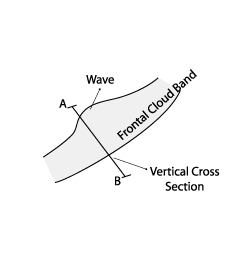
Wave - Typical Appearance In Vertical Cross Sections
by ZAMG
- Isentropes :
Isentropes show mainly frontal character. No impact from Wave. - Temperature Advection:
Maximum at 300 hPa or at higher levels, associated with tropopause folding (related to potential vorticity), cold advection below the Wave bulge at lower levels. - Vorticity Advection:
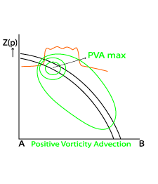
Significant maximum of positive vorticity advection at upper levels connected to the sharpening of the upper level trough at 300 hPa. - Vertical motion:
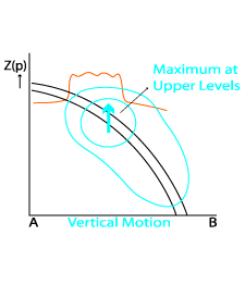
Vertical motion indicates rising air, with the maximum at upper levels, due to a rising upper relative stream.
|
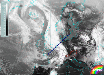
04 July 2005/12.00 UTC - Meteosat 8 IR 10.8 image; position of vertical cross section indicated
|
|
|
|
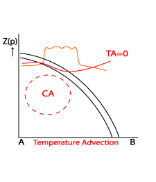
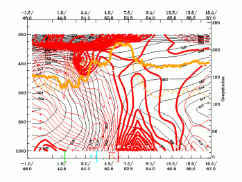
Temperature advection: vertical cross sections from numerical model
|
04 July 2005/12.00 UTC - Vertical cross section; black: isentropes (ThetaE), red thin: temperature advection -
CA, red thick: temperature advection - WA, orange thin: IR pixel values, orange thick: WV pixel values
|
|
|
|
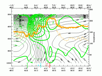
Positive vorticity advection: vertical cross sections from numerical model
|
04 July 2005/12.00 UTC - Vertical cross section; black: isentropes (ThetaE), green thin: vorticity advection -
NVA, green thick: vorticity advection - PVA, orange thin: IR pixel values, orange thick: WV pixel values
|
|
|
|
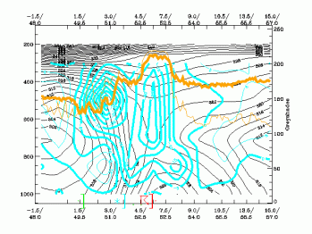
Vertical motion (Omega): vertical cross sections from numerical model
|
04 July 2005/12.00 UTC - Vertical cross section; black: isentropes (ThetaE), cyan: vertical motion (omega) -
upward motion, orange thin: IR pixel values, orange thick: WV pixel values
|
|
|
|
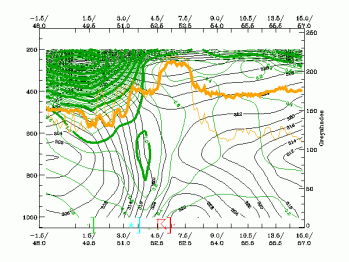
Potential vorticity: vertical cross sections from numerical model
|
4 July 2005/12.00 UTC - Vertical cross section; black: isentropes (ThetaE), dark green thin: potential vorticity
<1 unit, dark green thick: potential vorticity >=1 unit, orange thin: IR pixel values, orange thick: WV
pixel values
|
|
|
|


