Water Vapour Vortices - Cloud Structure In Satellite Images
by KNMI and FMI
Appearance in Meteosat imagery:
- WV Imagery:
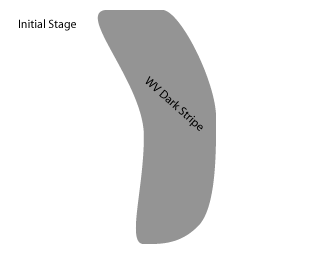
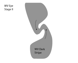
- Initial "old" Dark Stripe, associated with a former baroclinic zone. (compare Water Vapour Dark Stripes )
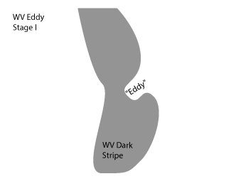
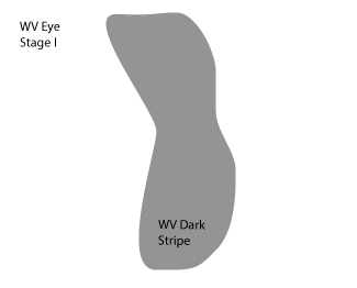
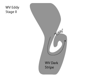
- During development a cyclonic structure forms. In the case of a WV Eddy, air with higher moisture content, spirals around drier air. In the case of a WV Eye, dry air is being surrounded by moist air and eventually a dark, round spot will be formed.
- IR/VIS Imagery:
- The main features of this conceptual model can only be seen in WV images. However, near the centre of a WV Eye cloud production can be suppressed, or clouds can dissolve.
|
|
|
|
|
|
|
|
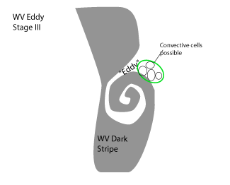
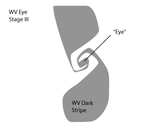
| WV Eddy | WV Eye |
| A mesoscale cyclonic spiral structure with wet and dry air masses forming the spiral | A dark, almost round spot which has been encapsulated by moister air |
| Developing due to the deformation of one edge of the Dark Stripe (see schematics above) | Developing due to the deformation of both edges of the Dark Stripe (see schematics above) |
| Some small cloud cells may exist in the leading part of the wet air stream, close to the transition zone between the high and low WV values. | No convection occurs. Significant drying out of middle and upper levels of the troposphere and even dissipation of lower cloudiness (clear spells). |
| End stage: Filling with moist air due to convection | End stage: Merging with other system, disturbed by mountains or disappearing by overrunning moist air |
| In some cases: a WV Eddy transforms into a WV Eye |
|
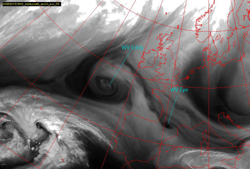
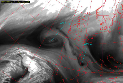
15 February 2008/18.00 UTC - Meteosat 9 WV 6.2 image
|
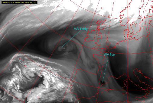
16 February 2008/00.00 UTC - Meteosat 9 WV 6.2 image
|
|
|
|
|
|
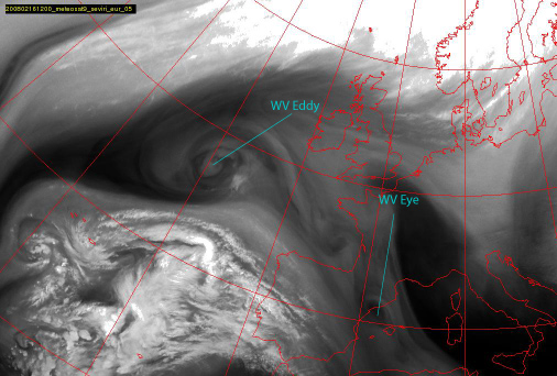
16 February 2008/06.00 UTC - Meteosat 9 WV 6.2 image
|
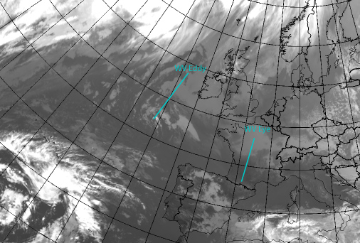
16 February 2008/12.00 UTC - Meteosat 9 WV 6.2 image
|
WV Eyes can develop in series - also in this case one can see even one or two additional small-scale WV Vortices extending from the Bay of Biscay towards the Pyrenees.
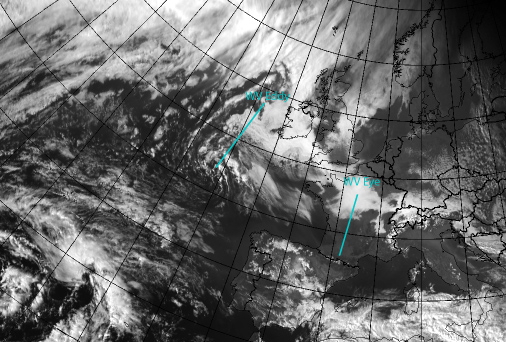
In the VIS and IR imagery below, for WV Eddy a little bit of Stratocumulus Sheets can be seen and the convective cells near the Eddy centre can be seen in the VIS channel, but no defined cyclonically rotating cloud band exists. For WV Eye there is no associated cloudiness at all.
|
15 February 2008/15.00 UTC - Meteosat 9 IR 10.8 image
|
15 February 2008/15.00 UTC - Meteosat 9 VIS 0.6 image
|
|
|
|
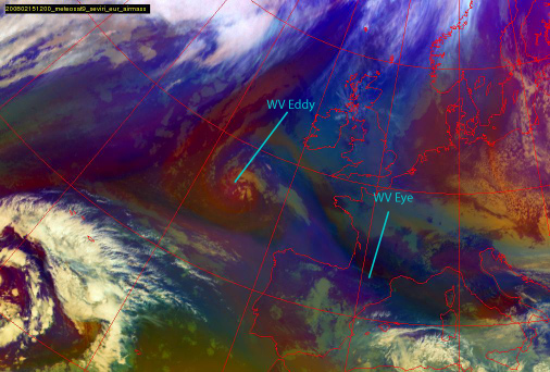
15 February 2008/12.00 UTC - Meteosat 9 Airmass RGB image
|
|
|

