WATER VAPOUR DARK STRIPES
by KNMI
Meteorological Physical Background
One of the main features in WV images are rather narrow Dark Stripes lying along the cyclonic side of bright bands and fibres. Typically they occur on the cyclonic side of a jet axis, to the rear of Cold Fronts and Occlusions, and along the leading edge of Warm Fronts.The Dark Stripe represents sinking dry air which could be of stratospheric origin. As such, the stripe can be used:
- as an indication of cloud dissipation from above
- to indicate possible unstable development at the boundary between dry and moist air
Consequently, Dark Stripes are not really conceptual models but are important key parameters within numerous other conceptual models, e.g.:
- Rapid cyclogenesis (see Rapid cyclogenesis )
- Wave (see Wave )
- Jet Cloudiness (Fibre at Jet Axis) (see Jet Cloudiness (Fibre) )
- Front Intensification by Jet Crossing (see Front Intensification by Jet Crossing )
- Cold front (see Cold front )
- Occlusion (see Occlusion )
- ULL (see Upper Level Low )
Dark Stripes in WV images are especially useful if they are combined with relative streams where they can frequently be found associated with dry intrusions as well as with isentropic potential vorticity.
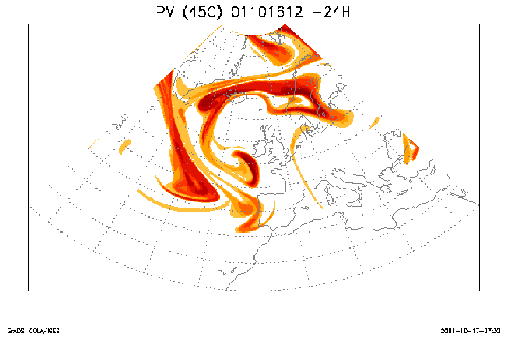
Dark Stripes in WV images are often accompanied by PV anomalies. The distribution of PV shows a long narrow elongated zone of high PV gradients within the Dark Stripe, often with separate maxima.
Dark Stripes in WV can also be used to detect discrepancies between numerical models and actual observations because of the tight relationship between PV and WV.
WV Dark Stripes are not only associated with Potential Vorticity but can also be used as indicators for the advection of Potential Vorticity. Because of the fact that Dark Stripes are narrow and elongated they are difficult to find in numerical model output. Therefore, advection of Potential Vorticity can be used for more detailed forecasts of the potential vorticity field.
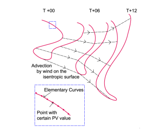
In contrast to eulerian and semi-langrangian methods, contour advection is based on a langrangian calculation. A potential vorticity contour advection field consists of a (finite) number of PV contours. A PV contour, in turn is represented by a number of points that are connected with small elementary curves. Every single point has a certain value of potential vorticity (see caption to the schematic below). The points are advected by the local wind on the isentropic surface. As a consequence, the PV contours can be deformed in complicated ways. The advantage of this method is that relatively fine scale features in the analysis can be followed more accurately in space and time than by traditional eulerian methods. However, one should realise that contour advection of PV only holds true under the assumption that the atmosphere is adiabatic and frictionless.
|
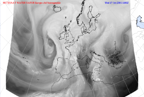
17 October 2001 - ECMWF +24h contour advection; 12 Z Potential vorticity on isentropic surface of 318K
|
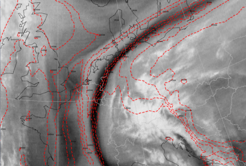
17 October 2001/11.00 UTC - Meteosat WV image
|
|
|
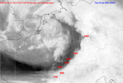
Dark Stripes and extreme Weather Events
In WV imagery, convection is sometimes considerably enhanced just ahead of narrow elongated Black Stripes. Heavy thunderstorms can develop in this area in the case where there is a warm and moist lower troposphere.When there is high windspeed in the lower part of the troposphere, strong gusts can be observed in the transition area from light to dark WV image values. This is the area were potential instability is at his highest levels in the area of the front (Cold Front or Occlusion).
Frontal convergence causes strong negative omega anomalies. This is a trigger for convection and the resulting mixing of wind from higher levels in the troposphere.
|
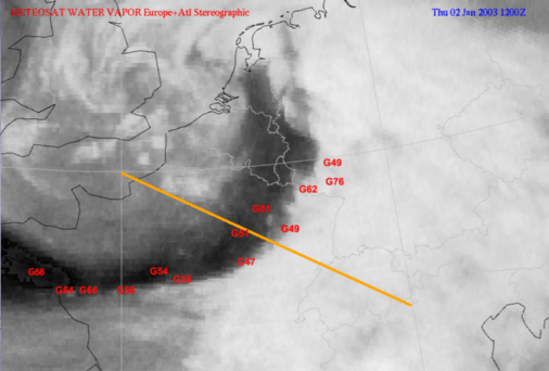
02 January 2003/12.00 UTC - Meteosat WV image; red: highest wind gusts in knots (11 - 12 UTC), position of
vertical cross section indicated
|
|
|
|
|
|
|
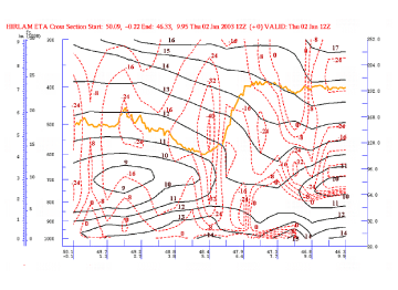
02 January 2003/06.00 UTC - Vertical cross section; black: isentropes (ThetaW), red: vertical motion (omega),
orange: WV pixel values
|
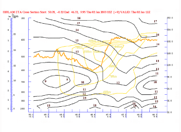
02 January 2003/06.00 UTC - Vertical cross section; black: isentropes (ThetaW), yellow: isotachs, orange:
WV pixel values
|
The sharp gradient from white to black in the WV image corresponds to the area of a distinct omega minimum and also an area were the potential instability is high (ThetaW values are decreasing up to 700 hPa). This is also the area were high wind speed values can be found low in the atmosphere (e.g. 60 kts below 800 hPa)